mercredi 31 janvier 2018

Super Secret Campsite visit, SLWA, 31 Jan, 2018

A couple weeks ago, Justin posted an awesome video of a backpacking trip to his Super Secret Campsite, deep in the Silver Lake Wilderness.

http://www.adkforum.com/showthread.php?t=25030

He mentioned that no one has yet to find it. Of course a Tick Magnet never backs down from a challenge, especially one in the SLWA. Today was my attempt to find this so called, Super Secret Campsite.

Arriving at the trailhead early, I suited up for a long walk in sunny, 6° weather.


I signed in at the register and noticed Justin's name a couple rows above mine. I did a good deed and put a new pencil in the box as the old one was pretty beat up. I hope everyone likes Minions :D On went the snowshoes to begin the gradual ascent up the trail.


Yellow disks marked this route along an old road.


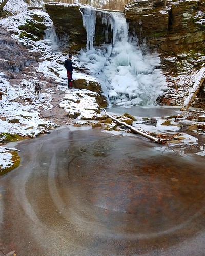
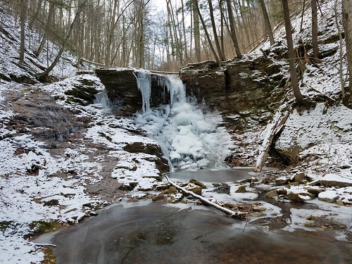
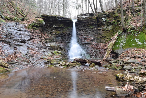
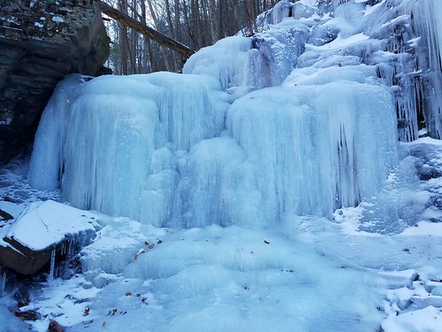
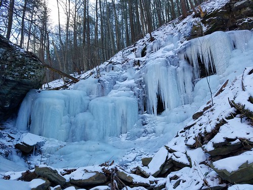
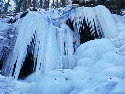
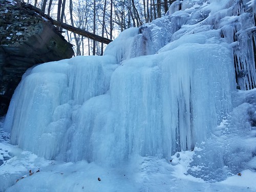
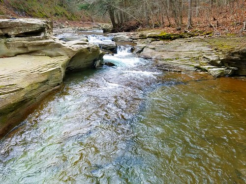
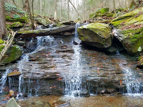
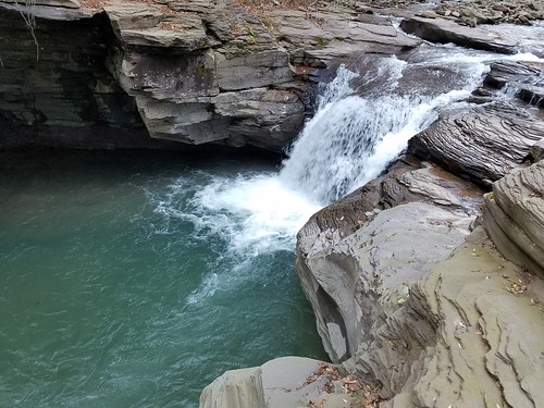
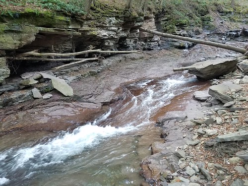
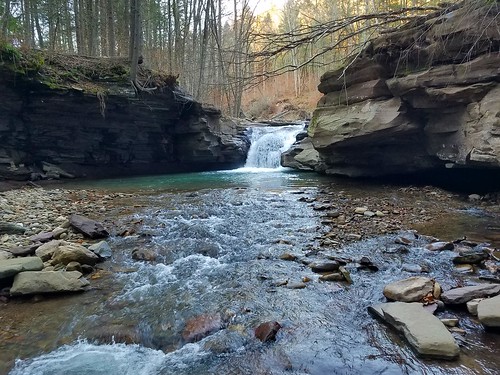
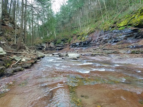
The trail eventually left the old road and paralleled a nicely frozen creek.


The post holes on this section of trail were horrible. They must have sunk down at least a foot. It will take a lot of snow to fix this problem.


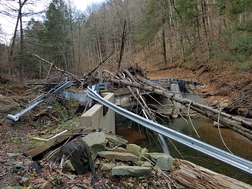
After walking along the creekside trail for about ten minutes, I came to the large bridge.


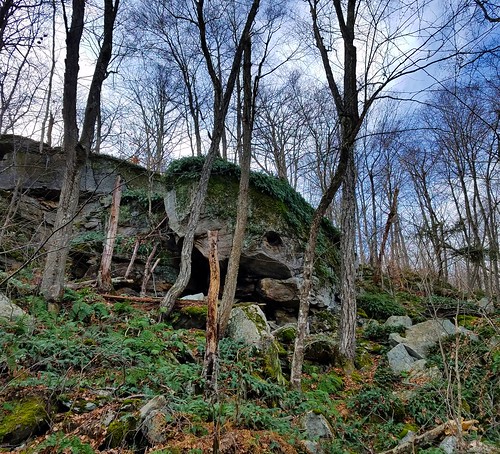
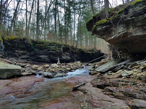
I crossed over to the other side (so to speak) and walked for another ten minutes until it was time to turn off into the woods and search for the old industrial site where Justin got his repurposed wood rack. I found the site with no problems.


Despite the snow, quite a bit of the ruins were visible including a pile of bricks and some old iron dating from the 1880s.


When I was finished exploring the site, I set a compass heading for where I thought the Super Secret Campsite might be. The route took me up and over the shoulder of a hill and through some spectacular open hardwoods.


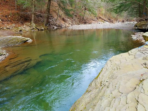
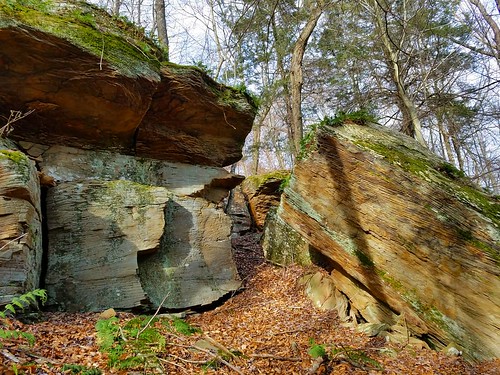
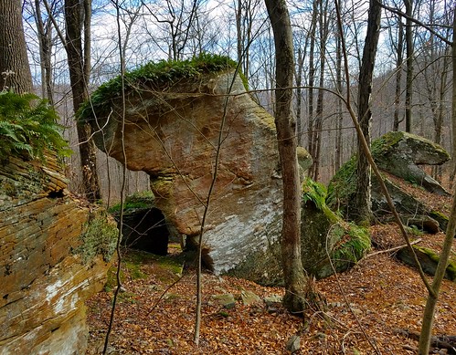
After reading the terrain and adjusting my bearing a little, I came to a nice flat spot alongside a small headwater. Sure enough, there was the Super Secret Campsite. :clap:


I quickly took advantage of the "furniture", sat down and poured a cup of hot tomato soup to celebrate my find. I thought about leaving a calling card, but my little LNT voice said "no". All that was left to do was play a little air guitar, pack up and head out back down the hill to the trail. Even though it was pretty cold and windy out this morning, I had a great time exploring a really neat area. It was an added bonus to find Justin's Super Secret Campsite. Your secret is safe with me, buddy.


Paradox Lake information

I’m just curious to see if anyone has had a good day out on Paradox Lake for pike. I’ve fished it a few times but never had a knockout day there. I would think the area around the channel would be good or one of the bays but I haven’t had much luck. Any information or advice is greatly appreciated thank you


mardi 30 janvier 2018

White Brook Falls-SGL 57

https://endlessmountains.wordpress.c...-falls-sgl-57/

This is a beautiful falls in SGL 57, featuring a graceful spout.* It is 20-25 feet tall in a gorge with boulders and smaller cascades and slides.* Our hike last month revealed ice flows and icicles.* In high water, the creek also flows down a steep slide to the left of the falls.


First-hand account of an accident on Giant Mountain.


[News] The latest Google Chrome update now supports HDR for Windows users

Chrome 64 now lets you mute entire sites that auto-play videos, in addition to adding support for HDR on Windows.

View full story here...


[News] Intel will roll out silicon-based fixes for Meltdown and Spectre this year

Intel has announced silicon-based changes to upcoming chips that will directly address the recent Meltdown and Spectre vulnerabilities.

View full story here...


[News] Samsung announces new SSD 860 Pro and SSD 860 Evo SSDs

Available in capacities from 250GB to 4TB and in a variety of form factors including 2.5-inch, mSATA, and M.2.

View full story here...


[News] AMD reveals specifications for its upcoming Ryzen desktop APUs with Vega graphics

AMD has revealed more detailed specifications of its upcoming Ryzen desktop processors with Radeon Vega graphics.

View full story here...


[News] The latest Google Chrome update now supports HDR for Windows users

Chrome 64 now lets you mute entire sites that auto-play videos, in addition to adding support for HDR on Windows.

View full story here...


lundi 29 janvier 2018

PBW Spitfire Seats

I recently acquired a used Spitfire. After years of rowing my beloved guideboat, it's just too difficult to portage (It's wood, 65 lb., I'm 71 and weaker than I used to be.) As for the boat, it is set up w/ a bottom seat for use with a double bladed paddle, but I prefer to use a single blade. The boat has cherry gunwales, and I'm wondering about the feasability of setting up a paddling thwart. It currently has two thin diameter laminated thwarts, but I'm not sure I'd trust kneeling and leaning my back against one of them. Any suggestions?


Big Pond, Hoffman Notch Wilderness

Enjoyed a fun & easy overnighter at Big Pond in the Hoffman Notch Wilderness this past weekend, with a quick side trip over to North Pond. Absolutely gorgeous weekend! Please enjoy the video...

Adirondack Winter Backpacking (Episode 9): Big Pond, Hoffman Notch Wilderness


dimanche 28 janvier 2018

Map of Fracking Sites in Adirondacks and NYS

Hi Folks,

It's my understanding fracking is occurring or may be in planning stages for many NY state locations. It's also my understanding that some of the current or planned fracking sites may interact with both DEC managed park and other lands. I searched for more information on this, where I hoped to find GPS coordinates (or a map) of these sites, however found little information. I thought I would at least find a map for the NYS parks, however again found little information. The only information I found shows a vague map of shale deposits towards the Western park of New York. This map actually contradicts other information I observed about these sites being in parts of the Catskills and Adirondacks, which are further North.

For the sake of understanding this better, does anyone have knowledge of these fracking sites or guidance on where the information exists? I would expect at least ADK to actively be promoting such accurate maps to inform the public.

Thanks so much,
Nick


Perhaps it's the hikers attitude that needs to change.

I happened to be skiing at a large public area close to home when I had this encounter.

It's quite a popular place for skiing and snowshoeing when there is snow, but we often have problems with barebooters ruining the trails. I contacted the county about these issues and was asked to join a group which helps to educate users and share the trails more responsibly.

Along my ski I ran into a couple hikers, both with bare boots. They were lost and asked me the quickest way back to the parking area. I gave them a couple options and tried to get on my way. I noticed that they had been walking directly in the ski track that had been set and one that had been undisturbed by hikers or snowshoers for a few days (because I had been out every day). There was a snowshoe track beside the ski tracks. I asked one of the gentlemen if he would walk outside of the ski tracks because his bare boots ruin them. His response was, "My feet are cold, I don't want to walk in the snow."

So not only were these gentlemen completely unprepared for the conditions, they ruined almost two miles of ski track (I skied the way they came in and they walked in the track the whole way and post holed it severely). And recall, they were lost. Granted it's a large tract of land, all the trails are marked and there are maps at each parking area.

I really wish hikers would get it together, they tend to be the most egregious offenders, the least prepared and the most clueless.


samedi 27 janvier 2018

Koerber Falls-SGL 57

https://endlessmountains.wordpress.c...-falls-sgl-57/


A beautiful 15-20 foot falls in a red rock grotto that features many wildflowers in spring. I visited this falls after the deep freeze, revealing impressive ice flows. The creek has many other smaller falls and slides in a narrow gorge.


vendredi 26 janvier 2018

'Mac' Bushey, Vermontville

Mac ran the store and gas station in Vermontville on Rte 3. He was always helping people and often wouldn't take a dime and this wasn't just with labor but this was often with his backhoe, digging cellars, digging outhouse holes, clearing roots and rocks out of driveways and even doing snow removal and there is plenty of snow up that way.
I think his real name was Robert, was it? And I believe his wife died early in a car wreck??
I've been told his safe was full of bills he wrote and never sent out and I know for a fact he often wouldn't take money for a job he did, rather he'd say, 'Catch me when I need it'...or similar. He liked helping newly weds get a start.
Anyone remember him?
I hope he isn't forgotten. He was a good guy.


APA Announces Boreas Ponds Classification

The APA went with Alternative 2B. A compromise for all...

Information can be found here;
https://www.adirondackexplorer.org/o...s/boreas-ponds

A map can be found here;
https://apa.ny.gov/Mailing/2018/02/S...ernative2B.pdf

I am looking forward to the Boreas Ponds being added into the High Peaks Wilderness. The most amazing expansion in a generation. The southern approach to the High Peaks will now be protected.


jeudi 25 janvier 2018

Indian Head & Fish Hawk Cliffs Conditions?

Looking to hike the Indian Head loop this Sunday (1/28) and am wondering if any of you have been out there recently and can tell me what kind of conditions I can expect to find?

Thanks!


Indian Head & Fish Hawk Cliffs

Looking to hike the Indian Head loop this Sunday (1/28) and am wondering if any of you have been out there recently and can tell me what kind of conditions I can expect to find?

Thanks!


Boreas Ponds News

Announced early today, the APA recommends “Alternative 2B” for the Boreas Ponds Tract.
Didn’t Alternative 2B receive the least amount of public support during the public comment period? :confused:

https://www.adirondackalmanack.com/


Pharoah Lake Wilderness/Lake George camping questions

Hey All,

I'm beginning plans for my family's Adirondack summer vacation, this year occurring the week of July4th (1st-8th). I've made a reservation for one of the remote sites on the pond at Putnam Pond Campground for the 1st half of the week. For the 2nd part, I'm thinking of staying around Lake George, where I haven't been for almost 15 years.

I'm looking at 3 campgrounds near Lake George- Rodger's Rock, Hearthstone Point, and Lake George Battleground. I'm wondering if anyone has any opinions or information to offer regarding these. Normally I'm not much for campground loop camping, but since we'll be primitive camping for the 1st half of the week, my wife would like a more "civilized" setting for the last few days, with the option to check out the village of Lake George. I wouldn't mind also having the option to take my kayak out on the lake, and perhaps a 3-6 mile hike to a place of interest (backcountry pond, peak, overlook, etc.)

I also have a few questions regarding Putnam Pond/Pharoah Lake wilderness. We're planning to spend most of time paddling around the lake and fishing, and dayhiking to the nearby ponds and Treadway mountain. 1st, can anyone comment about the quality of fishing on Putnam? I know there are pike, bass, and perch, and that tiger muskies have been stocked in the past. Are they still in there? I know they don't breed and Idon't know when the last stocking was. I've never caught a muskie.

As for the nearby ponds- Rock, Clear, and Grizzle Ocean- my fishing guide lists these as trout ponds. I'm wondering if anyone has had any luck fishing from shore here in high summer, or will I need to carry in a boat to have any chance of catching trout?

Any recommendations or insights are appreciated.


Lost Equipment in Colton

I was crossing the rt 56 bridge in South Colton Ny on Saturday night when my ice fishing sled i was towing tipped over an dumped my ice fishing gear on to the road way. By the time i realized it had happened and got turned around to go back for it some one stopped and picked it up and left with it in there car. I lost a clam plate auger, Eskimo Fatfish tent, Marcum fish finder, Rigid 18v drill and batteries, and a bag of polar tip ups. If anyone has any information it would be great to hear from you. Thanks,


mercredi 24 janvier 2018

Trapper 44mag


Phil Brown to retire

Saw this today and thought I pass it along...Congratulations to Mr. Brown on his forthcoming retirement. https://www.adirondackexplorer.org/w...-for-an-editor


A Gorges Commute

Perhaps you've seen the t-shirts and bumper stickers, Ithaca is Gorges. The weather this winter has the three I cross on my walking commute really showing off and I've been getting some nice pics.

Right by my house is Six Mile Creek, a city designated natural area. This is the first time in over a decade the ice has been smooth enough for skating so I cleared off a bit of snow and had a go at it. That lasted three days until it warmed up to the fifties and rain washed everything away. Then more snow arrived and highlighted the creek nicely.
Attachment 19023
Attachment 19024
Attachment 19025
Just upstream, but still less than a half-mile from hundreds of hotel rooms, is a double waterfall that has pretty consistent ice most winters. Despite efforts by many to allow it, ice climbing still is still forbidden except in rare, special occasions.
Attachment 19026
In the winter it´s tough to get good shots of Cascadilla Creek which sort of marks the south edge of Cornell Campus. There is a walkway right along the creek that contains a series of waterfalls over 30´ high, but this is Cornell natural area and they close it when ice forms on the cliffs and stairs.
Attachment 19027
Running right through Cornell is Fall Creek. Lots of waterfalls here too, and Cornell has a small hydro-power plant that generates about 2% of their electricity.
Attachment 19028
Fantastic ice built up on the cliffs by one of the falls after a melt off followed by single-digit temps. After passing through this deep gorge, the creek drops 100´ at Ithaca Falls. This is right across the street from the high school where I work. If I´d been a student this close to these falls I would have skipped some classes to hang out there. As a teacher I have skipped some classes to hang out there.
Attachment 19029
Attachment 19030
Attachment 19031
Attachment 19032
Three gorges, none of them State Parks (those are just outside of the city), less than a two-mile walk, and I can´t get co-workers to park at my house and walk with me.

Attached Images
File Type: jpg 1.jpg (139.6 KB)
File Type: jpg 2.jpg (137.2 KB)
File Type: jpg 3.jpg (125.5 KB)
File Type: jpg 4.jpg (122.5 KB)
File Type: jpg 5.JPG (113.7 KB)
File Type: jpg 6.JPG (120.6 KB)
File Type: jpg 7.JPG (126.1 KB)
File Type: jpg 7a.JPG (119.2 KB)
File Type: jpg 8.JPG (116.5 KB)
File Type: jpg 10.jpg (128.9 KB)


antler question

I recently found a six point buck on my property that had died earlier this season, before its antlers were shed. I do not know if it had succumbed to a hunter or whatever else the cause may have been, but it has been heavily preyed upon. At this point, there doesn't seem to be a scrap of flesh remaining. I would like to "harvest" its antlers for display.

My question is this- will the antlers separate from the skull on their own eventually? I don't want to saw them off- I want the "knobs" at their base to remain intact. Any ideas?

Anyone know if I'd be in violation of any game laws if I were to do this?

Thanks
Bob


mardi 23 janvier 2018

3 days of hiking and bushwhacking for Project 100.

My TR is posted on my blog.

It was a strenuous weekend. Was aiming for 6 peaks, 5 of which were whacks but left North River a-stragglin'.


Skygofree: highly advanced, powerful Android surveillance software active since 2014

Kaspersky Lab researchers have uncovered an advanced mobile implant, active since 2014 and designed for targeted cyber-surveillance, possibly as an ‘offensive security’ product. The implant, named Skygofree includes functionality never seen in the wild before, such as location-based audio recording through infected devices. The spyware is spread through web pages mimicking leading mobile network operators.

Skygofree is a sophisticated, multi-stage spyware that gives attackers full remote control of an infected device. It has undergone continuous development since the first version was created at the end of 2014 and it now includes the ability to eavesdrop on surrounding conversations and noise when an infected device enters a specified location – a feature that has not previously been seen in the wild. Other advanced, unseen features include using Accessibility Services to steal WhatsApp messages and the ability to connect an infected device to Wi-Fi networks controlled by the attackers.

The implant carries multiple exploits for root access and is also capable of taking pictures and videos, seizing call records, SMS, geolocation, calendar events and business-related information stored in the device’s memory. A special feature enables it to circumvent a battery-saving technique implemented by a top device vendor: the implant adds itself to the list of ‘protected apps’ so that it is not switched off automatically when the screen is off.
The attackers also appear to have an interest in Windows users, and researchers found a number of recently developed modules targeting this platform.

Most of the spoofed landing pages used for spreading the implant were registered in 2015, when according to Kaspersky Lab telemetry the distribution campaign was at its most active. The campaign is ongoing and the most recent domain was registered in October 2017. The data shows there have been several victims to date, all in Italy.

“High end mobile malware is very difficult to identify and block and the developers behind Skygofree have clearly used this to their advantage: creating and evolving an implant that can spy extensively on targets without arousing suspicion. Given the artefacts we discovered in the malware code and our analysis of the infrastructure, we have a high level of confidence that the developer behind the Skygofree implants is an Italian IT company that offers surveillance solutions, rather like HackingTeam.” – said Alexey Firsh, Malware Analyst, Targeted Attacks Research, Kaspersky Lab.

The researchers found 48 different commands that can be implemented by attackers, allowing for maximum flexibility of use.

To stay protected from advanced mobile malware threats, Kaspersky Lab strongly recommends implementing a reliable security solution that can identify and block such threats on endpoints, such as Kaspersky Security for Mobile. Users are further advised to exercise caution when they receive emails from people or organizations they don’t know, or with unexpected requests or attachments - and to always double-check the integrity and origin of websites before clicking on links.

If in doubt, call the service provider to verify. System administrators, in their turn, are advised to turn on Application Control functionality in their mobile security solutions to control potentially harmful programs vulnerable to this attack.

Kaspersky Lab detects the Skygofree versions for Android as HEUR:Trojan.AndroidOS.Skygofree.a and HEUR:Trojan.AndroidOS.Skygofree.b, and the Windows samples as UDS:DangerousObject.Multi.Generic.

Further information, including a list of Skygofree’s commands, indicators of compromise, domain addresses and the device models targeted by the implant’s exploit modules can be found on Securelist.com.

Source: http://www.techbarrista.com/beware-p...are-skygofree/


lundi 22 janvier 2018

Adirondack Winter Backpacking (Episode 8)

A new video, please enjoy...

Adirondack Winter Backpacking (Episode 8)


Picture Trouble

I've posted pictures successfully on several threads, but for some reason can't do it anymore. I'm doing it the same way as in the past, resizing the photos, uploading them as jpeg, then click on the file but this is all that shows up: Attachment 19022

Maybe you see a picture here, but on my browser I don't. I can see pictures on other posts, even my old posts.
Any suggestions?

Attached Images
File Type: jpg 4.jpg (122.5 KB)


Jay Mountain Road

Does anyone know how far past the Jay Mountain trailhead the Jay Mountain Road is plowed at this time of year?


Lahart's-Catamount-Forestdale-history

North of Whiteface Mtn is a mountain named Catamount which is part of the Taylor Pond Recreational Area and the mtn now being advertised as one to hike to get many out of the High Peaks.
Catamount is worthy though like the Peaks it will be spoiled. It has grand views in all directions, steepness, much exposed rock and a famous Couloir and the state in its infinite wisdom is now adding boardwalks and bridges to its main trail. It also once, the final remains could still be found in the 1970s, had a barb wired fence right over the summit and down the ridge line. Its hard to believe once you are on top but its true.
The fence came up from the Lahart farm sitting down below and was put their by Wilford Lahart [ b1911 and now deceased] and his Grandfather.
Grandpa, who came out of Canada, and fellow members of his family settled that valley and hand dug the pond across the Forestdale Rd from the house. By the pond the 2nd family moved to but little remains of their dwelling.
while the Lahart farm in much of its glory still stands though mostly idle.
Where the farm sits and just west of it at the junction of Forestdale Rd and Rosemond Lane was called 'West Kilns'. and there were a few Hops farms there, a school and Post Office. Hops could still be found in the 1960s/70s and the teacher lived with Lahart's.
Wilford told me if you misbehaved in school you got punished by the teacher and after supper by his dad, so he learned to behave.
The Lahart's and others were responsible for first putting in a corduroy road through the Catamount/Hearn Swamp valley so they could go to church in Black Brook-where many of them are now buried. Travel to church in the winter was done under bear and cow skins in a buggy [probably buggies since the family was large] with coal ember heaters under their feet.
Eventually the road was filled in from rock off Catamount brought down by big set fires to loosen and crack the rock, TNT and Steam Shovel.
Near those now overgrown cliffs from whence the road came from was a Basswood Forest where the Lahart's chased bees and downed trees to get their honey.
When I first climbed and hunted Catamount and met Wilford, the mountain was quite bare in many places but now is overgrown but underneath that tree canopy is a rugged place and the inexperienced should stay on the trail/s.
I once found a 38-55 Winchester shell half corroded away and wondered if Wilford hunted with something like that. His answer; Grandpa did. I thought that pretty interesting and wondered how long it would take for a brass cartridge to erode half away. His father died in the 30s so it must've been before then.
Headed east away from the farm and near the middle of Hearn Swamp is Middle Kilns, Further near the jct of the Silver Lake Rd, is East Kiln.
Sand piles where the kilns stood were easily seen in the 70s but now are mostly over grown tho a foundation lies at Middle Kilns if one knows where to look.
East Kilns is now a large private estate once owned by the JJ Newberry [think stores] family and is complete with indoor riding rink and more.
The kilns provided charcoal for both the iron mill in Ausable Forks and also the world's largest horseshoe nail factory in distant Chateauguay.
Barely any tree stood from Whiteface to Chateauguay...and occasionally one who looks in antique shops may find a postcard of that once mighty factory.


Fyi 1/22/18

Just a heads up to the community. Whiteface Toll Road is being plowed because of the construction at the Summit. Conditions were icy for a majority of the trip on this past Sunday.


Online Part Time Freelancers Needed!!!!!!

Looking for online freelancers!!!

Do your part time jobs anytime anywhere you want!

Earn up to 600RM per day just by using your mobile phone.

Suitable for poly students on holidays, working adults or ANYONE that want to have extra $$$


Whatsapp me @+6581180882 for more details


dimanche 21 janvier 2018

Hoagland Branch, Whale Rock, Warburton Hollow-Loyalsock SF

https://endlessmountains.wordpress.c...-state-forest/


A hike from November to the Loyalsock State Forest's Hoagland Branch area where I saw unique rock formations, including Whale Rock, a view, waterfalls in beautiful Warburton Hollow, rapids and deep swimming holes in Hoagland Branch, and deep gorges. I also saw the devastating effects of the 2016 flash flood which ripped out a road, twisted guardrails, and covered a bridge with trees.


A trace of Verplanck

In 1985 I had the privilege of climbing the south slides on Marcy with the late Jim Goodwin [Tony's dad] and George McCleland [spelled wrong probably and also I believe now deceased] of the KV Mountaineer.
Above the slide and in the cripple bush below the summit I found a long iron bar [12ft maybe]. I asked Jim where it likely can from and he said, 'Colvin's Survey'!
Its still up there as far as I know as I couldn't fathom carrying it back to Jim's below the Garden.


Big Woods Buck

All right folks have I got a buck story to tell you so buckle up and make sure your boots are tied because this one will knock your socks off. Now I know I’m a little late on the deliverance of this story and left a lot of pikebuster fans wondering how my deer season turned out. Well after much anticipation here it is...it all started in the deep parts of the ADKs. I like to get good and lost before I start hunting it just makes the trips more interesting. So there I was lost as hell not really knowing where is was headed. All I knew is I was heading to buck country, where the bucks are as big as Buicks and a man could feed a family of 10 for a whole year off one buck. So put on the lard and onions I’m gonna gut a buck. Now when I hunt I like to coat my self in doe piss, that way the bucks come to me and I have to fight them off. I know what your thinkin “pikebuster you’re a nut” well that might be true but by my logic you have to be a bit of a nut to be baggin deer with nuts. I got to the spot where I knew there’d be a chance to give a deer a good ol dirt nap. Then within a few minutes there he was he was, so rutiful so beautiful and he was comin right for me. So I got down on one knee I knew this deer wanted a fight, I had to steady my nerves. He had one of his main beams bust off, no doubt he’d been head buttin’ tree huggers (they have pretty thick heads). So I checked the wind, made sure the barometric pressure was just right because this was gonna be one heck of a shot. I figured that he was at least 20 yards away, not an easy shot at all. I leveled off on his front shoulder, placed my booger hook on bang switch and then I proceeded to bring the hate. He ran a bit then went down, then the real work began, i quartered him up tore the head off the body of the deer because I didn’t have a saw to cut the horns off the head(that would have made it too easy which isn’t how I operate). Now first things first before I started the hike back, I always carry a Busch light with me, it’s apart of my survival pack. So I sat there had a beer and thought about the 12 plus miles I had to take this deer to my truck. But then again that’s what hunting the ADKs are all about. Until next year


Colden46, do you have access to BirdsEye data?

Starting a new thread on this - I was reminded of this today while bushwhacking:

I use the wonderful "Topo Map Browser" that Colden46 developed at the AdirondackPark.net site, and it works well. Of course the satellite photos are mostly the Google "straight down" photos. But in some locations, when you zoom in, the view switches to the angled, rotatable "Birds Eye" view. (A good place to see this is at Hoover Dam.)

Interestingly, on Bing's own site, the Birds Eye view is NOT available at Hoover Dam. But it IS available on the "Topo Map Browser."

So Colden46, somehow your topo map software is tapping into the old "Birds Eye" data at some locations. Do you know how it's doing this? Is it possible we might be able to recover access to this data base in the Adirondacks?


samedi 20 janvier 2018

Found - Mens Hiking Boots - Cascade Parking lot

If anyone left a pair on mens hiking boots in the Cascade Mountain parking lot before 3:30 PM on Saturday 1/20/18, let me know. I can get them to you!


The Barren Lands Collection

I haven't had a chance to fully check this out but I'm certain it will be of interest to some here:

https://barrenlands.library.utoronto.ca/

The objective of the Barren Lands digital collection was to digitize and provide web access to the archives of Canadian explorer J.B. Tyrrell.


Good winter mountain hike - non-peak and peak

I'm looking for a good beginner snowshoe hike in the High Peak region to do before attempting a High Peak, and then would like recommendations on a high peak that would be good for the first winter ascent.

We've done Marcy, Porter and Cascade in the summer, and would like a different one.

Thanks!


vendredi 19 janvier 2018

Goodnow footwear and snow conditions

Looking at Goodnow this weekend. Thinking decent snow cover and the snowshoes would be best bet. Plus warmer temps may soften a bit. Definately do not wish to damage trail (posthole) and intend to just carry the micros. However, taken SS for too many rides on my back.....so.....thought or predictions on footwear?

As a reference did Kane last Sunday (Jan 14). Micros were perfect, everything frozen solid, and the few folks we passed on snowshoes not happy (due to firmness and rocks). Should be major snow difference in Newcomb compared to north of Johnstown.


Mill Creek Falls-Loyalsock State Forest

https://endlessmountains.wordpress.c...-state-forest/

A beautiful 12 foot falls with a deep aquamarine pool, surrounded by a gorge of ledges and cliffs. There are also bedrock slides and other pools. In 2016, this stream was hit with an epic flash flood that scoured the gorge walls, triggered landslides, and moved large boulders with ease. The falls were unscathed, but the effects of the flood are obvious.


Xc skiing NW Bay brook

Hi all, I was looking for a relatively easy ski near the Sagamore because we’re planning to go to the ice bar later… I had an idea that maybe it be nice to ski from the fishing access on route 9N, follow the northwest Baybrook and pick up that trail that goes along the tongue shoreline that goes to the point it looks looks pretty flat. Anyone have any thoughts on this? With all the recent melting and refreezing, I’m not sure about the thickness of the ice… I am not sure if there might be blocks of ice jammed up… I don’t remember that Brooke having that much current but who knows after our recent weather!

Also was thinking Amy’s Park might be good with its flat marshy areas… Any other suggestions? Ps We do not like groomed trails
Thanks!


jeudi 18 janvier 2018

Chase Lake, SMWF, 18 Jan, 2018

Today was a great opportunity for Tredhed and I to revisit Chase Lake in the Shaker Mountain Wild Forest. We hadn't been here in a few years and Tredhed had never done a winter loop hike across the lake from the old lean-to site. That was today's plan, hike the trail to the old lean-to site (now a designated campsite) and cut across the lake to the new lean-to. From there we would follow the "new" trail back completing the lollipop route.

Arriving at the well plowed Pinnacle Rd. trailhead around 9:00


After sorting out some issues with my bindings, we set off down the red disked hiking trail.


The snow conditions were great with a few inches of fresh powder over a hard base. In a short time, we came to the junction between the lean-to trail and the designated campsite trail. (Sorry for the picture size issue...operator error on my part)


We took a break for a few minutes and then proceeded down the yellow disked trail to the designated campsite. We broke trail for the .8 miles to the lake shore as no one had yet traveled this way. The trail had a couple spots of blowdown, but was an absolute joy to walk on.


Before we knew it, we arrived at the designated campsite. While not a great location for a camp, it wasn't terrible either.


The best part of the hike was the .3 mile walk across the frozen Chase Lake. The views of Pinnacle were pretty spectacular. Certainly something most people don't get to see if they only visit the lean-to.


The sheer cliffs were especially noticeable in the bright sunshine.


At one point, I stopped to glance back at our tracks. What a sight.


After crossing the lake, we arrived at the lean-to for lunch. Unfortunately, the lean-to needed a little tender loving care before we feasted. Someone decided to hang hemlock boughs from the head log and scattered the floor with them. :mad: Upon closer inspection, we saw they had also started a small fire on the floor of the lean-to. :gripe:


While Tredhed got the stove going, I cleaned up the mess and filled a shopping bag with assorted lean-to garbage. The hot soup sure tasted good as the wind picked up and snow flurries began to fly. When lunch was finished, we left the lean-to... a lot cleaner than when we found it.


We completed the lollipop route by heading out on the recently cut red disked trail. The restless trail wandered up and down a little, crossed a few streams and finally brought us to the junction in about a mile.


All that was left to do was follow our tracks the 1.7 miles back to the trailhead. After arriving at the car, we called the forest ranger number listed at the register and reported the gross buffoonery we saw. Lean-to shenanigans aside, it really was a great little hike today. While we only walked a little over five miles, it was a good stretch of the legs and got us out in a very pretty part of the southern Adirondacks.


mardi 16 janvier 2018

Question on Solo Plus

Good afternoon,

Backstory - this saga all started some years ago but then life got in the way. Getting it going again.

Quest to build small quiver of solo canoes - wanted one for rivers and one for lakes. I bring comfort gear and lots of it when the portaging isn't too bad. I am 270 lbs. and 6' 2" with extremely short legs. Large wingspan. Sit and switch. Week long+ trips. Coolers, fish finders, wet bar, the whole thing.

Great help from the boards. Narrowed it down to a Rockstar for the twisty bits and a Wilderness for the flats.

Two years ago while washing my canoe in the front yard my 65lb dog jumped in. Now he is a fixture on just the flatwater trips. Even has his own Thermarest and my 70's era North Face Puma jacket for a sleeping bag.

Question - while I believe the Wilderness would be fine for me and my comfort gear on the flats I am wondering if I need to go larger due to the added weight and his comfort gear. I do love my dog.

I really don't want to mod a tandem. Would a Solo Plus rigged dedicated solo do the trick? I have been searching forums and can't quite square this away in my mind. Some feel it is a good solo but with no rocker it doesn't turn well, which for this application I feel would be ok.

I appreciate any help.

Thank you.

Viking


[News] ASUS found a way to make the bezels disappear in a multi-monitor setup

[IMGALIGN=right]http://ift.tt/2D5NU0F]The ASUS ROG Bezel-free Kit uses vertical lenses and mounts to make the bezels on your multi-monitor setup disappear.

View full story here...


lundi 15 janvier 2018

Risking security for an easy life: people’s password dilemmas revealed

Today we log into online accounts all the time – from transferring money between bank accounts, to simply ordering some food, shopping, checking the weather, or booking a taxi on a night out. But what if suddenly you can’t log into the account you need, when you need it? What if you get the dreaded ‘password error’ message? Do you end up not being able to get home in time, or going out without a coat in the rain? With the reality sometimes being much more serious than that, Kaspersky Lab research has revealed the dilemma people face when protecting their online accounts.


With our increasing dependency on online accounts to get us through our day-to-day lives, Kaspersky Lab has found that people are increasingly facing a dilemma – how to choose their passwords. Some end up using strong and different passwords for every single account so that nothing can be hacked or exploited, but risk forgetting their passwords in the process. Others choose memorable passwords that make their lives easier, but also play right into cybercriminal hands.

Answering the dilemma option one – strong passwords that are hard to remember

According to research from the cybersecurity company, many consumers understand the need for strong passwords on their accounts. When asked which three of their online accounts required the strongest passwords, 63% of consumers selected online banking accounts, 42% selected payment applications including e-wallets, and 41% online shopping.

However, the difficulty of remembering all these strong passwords means people are likely to forget them and still get locked out of their accounts. Two-in-five (38%) people cannot quickly restore passwords to their personal online accounts after losing them. This may lead to feelings of frustration or stress if they can’t carry on their normal activities as a result.

When it comes to password storage, half (51%) store passwords insecurely, with a quarter (23%) writing them in a notepad so that they don’t have to remember them, which also puts their security at risk.

Answering the dilemma option two – weak passwords that are easy to crack

As an alternative answer to the password dilemma, and to avoid the frustration of having to remember long passwords, some people are developing other insecure password habits instead. For example, 10% use just one password for all accounts, allowing them to live their online lives seamlessly, without ever struggling to remember how to login to anything. That’s until a cybercriminal gets hold of that one key password and unlocks everything for themselves, of course.

Indeed, 17% of the consumers surveyed by Kaspersky Lab have faced the threat of, or have successfully had, an online account hacked in the past 12 months. Emails are the most targeted accounts (41%), closely followed by social media (37%), banking accounts (18%) and shopping accounts (18%).

Answering the dilemma – there is a third option after all
According to Kaspersky Lab, consumers don’t have to be limited to just two options in answering their password dilemmas. There is in fact no need for them to compromise, as Andrei Mochola, Head of Consumer Business at Kaspersky Lab explains, “If people have strong passwords that they can remember, they will not only be able to access everything they need, whenever they need it, but the information held in their accounts will also be secure from hackers. This is important to consumers that just want to get on with their day-to-day lives in safety – allowing them to, for example, find someone’s contact information, recall a specific meeting place, win the war in their favorite game, check their emails, or order something they need when they want, without revealing their information to any hackers or criminals.

“But remembering secure passwords is difficult, meaning users face a password dilemma every day – and often either forget strong passwords or end up creating passwords that are easy to remember but also easy to hack. However, there is a third option which can bring consumers peace of mind – using a password manager solution allows people to have strong passwords, without having to write them down in notepads or remember complicated strings of words with special characters”.

To help consumers regain control over their sprawling online identities, Kaspersky Password Manager stores all of a user’s passwords in a secure vault. They only need to remember one master password in order to access all of their accounts, taking away the panic felt when access is prevented for whatever reason. Through a free My Kaspersky account, users can access their passwords via any device, no matter where they are or what time of day, helping them keep accounts and valuable information secure and only available to the user. The automatic password generator feature also helps create strong passwords, taking away the pain for users but giving hackers a big headache.

For more information about how Kaspersky Lab products can help consumers remain in control and on top of their online accounts, visit http://ift.tt/2mVLv3h.

Source: http://ift.tt/2FG2spy


Sheriff won’t comply with uncon order!!!

Check out this you tube video.
Search, Sheriff Carpinelli won’t comply with unconstitutional order.
I salute my county Sheriff.:thumbs::thumbs:


Popular ski trails in northern Vermont

I want to take my friend in northern vermont skiing this weekend, preferably something ungroomed but popular enough for trail to be broken. Small to moderate hills good for a first timer, any suggestions?

I was thinking maybe Lake Carmi, I know there are nature trails there. Anyone know if they are usually broken during the winter? Any hills in the mix? Thanks!

Or a website with good info would be helpful too. I couldnt find much on ski trails other than groomed centers.


Middle Saranac Lean-to

Is there still a lean-to on the southeast shore of Middle Saranac Lake near the mouth of Dutton Brook?

Some maps show one, others don’t.


samedi 13 janvier 2018

Waterfalls, Vistas, Old growth Hemlocks-SGL 13

https://endlessmountains.wordpress.c...branch-sgl-13/


A rugged off trail hike around the plateau between Sullivan Branch and Heberly Run, two stream famous for its waterfalls. This hike also featured waterfalls, vistas, cliffs, old growth hemlocks, and cascading springs. One falls was about 60 feet tall. I found an old grade east of Heberly Run which provided a convenient way to finish the loop. A tough, beautiful hike with some great views.


vendredi 12 janvier 2018

3 or 4 day loop ideas with a large dog

Hello all!

My friend and I are planning a 3-4 day loop hike that is also appropriate for my Bernese Mountain Dog who is used to backpacking trips and carrying his own pack. We are both experienced hikers but have never been to the Adirondacks before. Any suggestions of suitable loops that have low to moderate traffic (with some great views!) would be awesome. Thanks in advance for any advice! Cheers.


jeudi 11 janvier 2018

Why build a cabin when you can live anywhere?

http://ift.tt/2DmKqId

Anyone seen these? Looks like the high tech version of a snowtrekker.

Damn expensive, but cheaper than land, a cabin and taxes.


Cold Run Trail-Worlds End State Park

https://endlessmountains.wordpress.c...nd-state-park/


Worlds End State Park has long been one of PA's premier state parks for hiking with miles of quality trails in the park and surrounding state forest. Now it just got better. The excellent Cold Run Trail is now complete and features a view, gorges, waterfalls, streams, cliffs, boulders, chasms, and a boulder arch. This is a trail you need to hike. It is beautifully built and designed.