mercredi 31 octobre 2018

Marcy Oct 27

Original plan was to drive 6 hours to Adk Loj, hike in past Marcy Dam Fri night, go up and over Marcy and try for Skylight and Gray. Possibly bag Tabletop on way back.

Well - I have to do a bit better with pre-trip prep. Left late, got to Loj at sunset on Fri. Could have hiked in under headlamp, but heck - a nice leanto with a campfire was sounding pretty good after hectic packing and long drive. I don't mind hiking at night, I don't mind hiking on ice, I don't mind hiking unfamiliar trails - but all three at once when not needed seemed unnecessary.

A great night in Leanto, temps in low 30's. Skim ice on water bottles in morning. Got on trail at 7:30.


As expected trail had more snow and ice as we worked ourselves higher. Put on spikes between Marcy Dam and Phelps trail. Left them on for remainder of day. Stopped again to layer up prior to leaving tree line.


Made good time (for us) and reached peak after 5 hours. As expected from weather mountain top forecast there were severe winds (40-50mph). Could not really stand up for casual selfies. Sleet was akin to having one's face sandblasted.


These conditions paired with our late start and skill level prompted us to skip Skylight and Gray. Did not want Marcy between us and camp. Visibility was such that compass & cairns used to get back to tree line.

Weather took a turn, warmed up a bit, so now it was sleet and rain so we hiked right by Tabletop too on way out. We were warm and dry but wished to enjoy the day by getting off trail sooner than later. I'd say on our way out there were two more inches of snow on the ground.

Trail well traveled. Maybe 50/50 with hikers that looked prepared and ones that looked less than prepared.

Lessons from this trip
  • Always good to know when sunset is, but also moon-rise. Dark at 7pm Fri night but I could have almost read a book at 1am.
  • A box for the fiddly bits of gear that go on shelf for every trip. Separate containers for summer, winter, canoe, etc.
  • Still need to work on trail food. exertion makes some food hard to get down.

Thoughts on Gear
  • Still loving Primaloft. Jacket and gloves. The gloves were soaked but still warm.
  • May look into water proof gloves or a vapor barrier like Trailboss uses.
  • Need either a puffy or another primaloft layer for camp. We had enough layers, but they were bulky.
  • Hiking pants with magical water repellent finish were fantastic.
  • Got better use from Giai GPS on cell phone.
  • Yes, technically the one piece fleece Halloween costumes would have made nice sleep gear / outer layer but fellow hikers might feel a tad odd when confronted with giant chicken on trail. Close enough to Halloween though - we could have pulled it off.


Boatbuilding story

I saw this in our local paper & thought forum members who are into boatbuilding might enjoy it. If the local-paper link doesn't work, it mentions that there are Youtube videos about the Arabella project, too.
https://www.gazettenet.com/Acorn-to-Arabella-21183384

(edit) the Youtube videos are called "Acorn to Arabella"


Deer Processors

Hi all,

Looking for a deer processor in the Lake George/Saratoga area in the event that I'm lucky enough to fill my tag this weekend. Can anyone here recommend a processor that they've used or heard of?

Thanks in advance and good luck out there!


mardi 30 octobre 2018

bao gia go thong nhap khau

Công ty Tigerwood chuyên cung cấp Gỗ thông newzealand Uy tín chất lượng
Bạn có biết rằng gỗ Thông nhập khẩu hiện nay đang là một trong những cái tên “hot” và được nhiều người quan tâm đến khi tìm mua gỗ nguyên liệu? Trên thị trường hiện nay, có thể thấy gỗ Thông nhập khẩu là một trong những loại gỗ được sử dụng khá phổ biến trong ngành chế biến gỗ công nghiệp. Với những đặc tính ưu điểm sẵn có gỗ Thông đang dần chiếm lĩnh một thị phần rộng rãi trong lĩnh vực thiết kế &thi công nội thất. Như vậy, câu hỏi đặt ra ở đây là gỗ Thông “hot” ở điểm nào? Nếu bạn còn đang băn khoăn thì bài viết dưới đây sẽ giúp bạn hiểu rõ hơn về*gỗ Thông nhập khẩu.

Gỗ Thông có một*ưu điểm nổi bật đó chính là tính kháng khuẩn cao, không gây mùi, dùng an toàn với nhà có trẻ nhỏ. Thích hợp để làm giường cho bé, giường tầng, đồ dùng gỗ. Nhờ khả năng kháng sâu tự nhiên có trong tâm gỗ, dòng sản phẩm này không cần khách hàng phải mất thêm bất cứ khoản chi nào cũng như không phải dùng đến hóa chất bảo quản ảnh hưởng đến sức khỏe.*aa

Ngoài* ra Thông nhập khẩu còn có thể ứng dụng để đóng bàn ghế ngồi trong các phòng như : phòng khách, phòng ăn nhà bếp, trang trí ốp tường, có thể làm hệ thống trần gỗ tự nhiên hoặc vách gỗ văn phòng trang trí, kệ ,có thể là kệ trưng bày chứa nhiều loại vật dụng khác nhau.Cũng có thể làm sàn cho nội và ngoại thất,bảng hiệu gỗ cơ quan hay quán café . Thiết kế giường,tủ treo đồ, bàn làm việc trong văn phòng, cầu thang nội thất, quầy bar tính tiền , khung treo ảnh logo, …Với giá thành thấp, màu sắc vân, bề mặt gỗ, cấu tạo đặc biệt giúp gỗ Thông nhập khẩu mang cho mình một phong cách riêng. Để biết thêm thông tin chi tiết*Giá Gỗ Thông Nhập khẩu*xin liên hệ 0907665335 hoặc xem gỗ thông tại :*https://www.youtube.com/watch?v=7DFplXR-5yA


lundi 29 octobre 2018

Scored

I shot my buck early this year. Great 8 point about 170lbs dressed.

https://photos.app.goo.gl/wKPz1PQdguW3ATro9


IMG]https://photos.app.goo.gl/PV48Z7GuBdkGXj1h9[/IMG]

https://photos.app.goo.gl/Rwhadv3uzUSp3eSW9


dimanche 28 octobre 2018

Whiteface highway

Would like to know current conditions on highway...thanks


Nhung bieu hien cua tri thong minh thien nhien

Những biểu hiện của trí thông minh thiên nhiên

Theo nhà khoa học Gardner, mỗi cá nhân khi sinh ra đều sở hữu đến 8 loại hình thông minh khác nhau. Mỗi loại hình thông minh này lại có những biểu hiện, đặc điểm khá rõ nét, cụ thể để biểu hiện.

Một trong số 8 loại hình đó, chúng ta cũng cần biết đến đó chính là trí thông minh tự nhiên. Loại hình thông minh này có những biểu hiện cụ thể như thế nào mời bạn cùng Sinh trắc vân tay uy tín chất lượng TPHCM Elite Symbol tìm hiểu về Những biểu hiện của trí thông minh thiên nhiên trong nội dung bài viết dưới đây.

Trí thông minh tự nhiên là năng lực tự nhận biết thực vật, động vật và các thành phần khác của môi trường tự nhiên. Những người này thích các hoạt động liên quan đến tự nhiên, yêu thích tìm tòi khám phá tự nhiên xung quanh mình. Những cá nhân sở hữu loai hình trí thông minh thiên nhiên cao là người có giác quan nhạy bén như thính giác, thị giác, xúc giác, vị giác, khứu giác.

Đặc điểm của người có trí thông minh thiên nhiên cao:

- Thích đi du lịch ở những thắng cảnh tự nhiên hơn, kiểu hòa mình vào thiên nhiên

- Họ luôn yêu thích công việc làm vườn, thích loại cây hoa…

- Thích nuôi những muông thú trong nhà

- Thích tham gia vào hoạt động làm sạch vệ sinh môi trường đô thị.

- Thích đi tham quan các công viên, vườn quốc gia có nhiều cây xanh, động thực vật độc đáo


Thông minh thiên nhiên là một trong 8 loại hình thông minh

- Thích xem các chương trình về thế giới động vật

- Thường có sự yêu thích những tranh ảnh phong cảnh hơn là những bức chân dung

- Có khả năng phân biệt chính xác các loài chim, cây và hoa

- Thích đọc sách tìm hiểu về cây cỏ và loài vật

– Có xu hướng bảo vệ và ủng hộ các tổ chức bảo vệ môi trường và thường xuyên tham gia vào tổ chức gây quĩ bảo vệ môi trường

- Biết rất nhiều các cảnh đẹp thiên nhiên ở quê hương đang sống và từng đến đó nhiều lần nhưng vẫn muốn tới.

Trong Sinh trắc học vân tay, những trẻ em thông minh tự nhiên thường có sự kết nối chặt chẽ với thế giới bên ngoài hay động vật và yêu thích các hoạt động ngoài trời.Những đứa trẻ này cũng thể hiện sự hứng thú với sinh vật học, thiên văn học, khí tượng học và động vật học.


Con có trí thông minh này thường yêu thích thiên nhiên

Biểu hiện của những trẻ sở hữu trí thông minh thiên nhiên:

- Thích được ở ngoài trời và ưa các hoạt động như: câu cá, đi bộ, đạp xe, cắm trại, leo núi.

- Thích sưu tầm và nghiên cứu về những vật liên quan đến tự nhiên như lá, hoa, đá…

- Hứng thú đặc biệt với điều gì đó trong tự nhiên.

- Thích quan sát và nhận biết những khác biệt tinh tế của thế giới tự nhiên.

- Thích các loại động vật và tìm hiểu về chúng.

Nâng cao trí thông minh thiên nhiên cho trẻ

- Kích thích niêm say mê sưu tập tranh ảnh động thực vật.

- Phân biệt các loại hoa, cây cối trong sân nhà hoặc khu phố.

- Tìm hiểu về các đặc trưng riêng biệt của các loại động vật

- Tham gia các hoạt động ngoài trời như cắm trại, câu cá, làm vườn…Trên đây là những Đặc điểm của người có có trí thông minh thiên nhiên cao mà sinh trắc vân tay Elite Symbol muốn chia sẻ với bạn. Để khám phá ra loại hình thông minh của con mình cũng như biết độ tuổi làm sinh trắc vân tay, mời bạn đến ngay với chúng tôi nhé.


samedi 27 octobre 2018

Camping Mt. Arab

Has anyone camped atop Mt. Arab? I hear there is a campsite just past the fire tower. I am wondering what it is like if anyone knows.


Select a gaming laptop?

Hi
My job is very strees and sometimes I want to play a bit. Now I'm thinking of buying a high-profile laptop to play the current heavyweight series. May you help me choose the best machine. thank you.


vendredi 26 octobre 2018

Hinckley to Blue Mt. Lake

One could walk from Hinckley Reservoir to Blue Mt. Lake without encountering any improved road. And the only seasonal road one would have to cross is the Moose River rd.

Correct me if false, if you please.


Sandy Bottom Vista- SGL 134

https://endlessmountains.wordpress.c...vista-sgl-134/

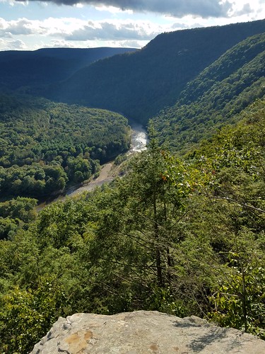
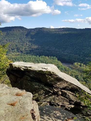
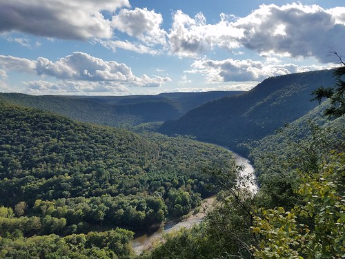
An off trail hike to a beautiful view from a cliff overlooking Sandy Bottom and the Loyalsock Creek, 700 feet below. The cliffs also had a pedestal rock with an awesome view. We also hiked an unnamed creek nearby, with large trees, cascades, and a fifteen foot falls. This hike is near Huckle Run.


mercredi 24 octobre 2018

Brooktrout Lake overnighter video

Deerless (fellow forum member) and I hiked out to Brooktrout lake last friday. The trailhead is off the indian lake road in the Moose river plains area, south of limekiln lake. The trail is gradually uphill for a good hour or so, then turns into rolling hills of varying terrain. It was tougher to follow the closer you got to Brooktrout. We had to stop a few times and really seek out those yellow tree markers. Many creeks and rocky sections to contend with. After roughly3 hrs you are meet with a steep decent and a partial view of the lake through the trees. We hiked to the far end of the lake and found the only site on the map. It has an older leanto with a huge rock in front of it which provided a nice firepit.
We ventured the next morning down the short half mile trail to west lake and took a few pics before heading back.

Brooktrout is a gorgeous lake that is very secluded. A worthy hike.

https://youtu.be/f9P3s0t0Z6o


New Bridges - Essex Chain Lakes?

Curious if anyone has more detail about this press release: http://www.adirondackdailyenterprise...of-lakes-area/

I'm interested in the bridge locations. I can't find anything on line. I am especially curious if this includes rebuilding the bridge over the Cedar River, or whether that project is still in regulatory review? I expect the latter, but the brief article above is non-specific.

Thank you!


mardi 23 octobre 2018

Raquette Lake Leanto at Hasbroucks

Guys,

Since 1978 I have used the leanto at the point referred to on the topos as Hasbrouk's across from Beecher Island at the north end of Raquette Lake.

It was a magnificent spot with the view of sunrise and sunset, a breeze to at least help keep the flies away, and a rock landing for a skiff or canoe 20 feet
from the leanto making lugging gear no issue.

I have been there with college buddies from NYC who knew nothing of the Adirondacks, my kids as they grew, and two years ago with an old pal from Syracuse who had never seen the Adirondacks. Everyone was amazed that it was there and free to use.

Just before Labor Day I went there solo and found my leanto had been moved 100 feet back into the woods where the outhouses had always been. The lake view and breeze were gone. No more the sunset from the leanto. No more the sunrise through the mist on the lake.

I understand the reason for the 100 foot rule for camping from water. It is to
protect bodies of water from human impact. But when Raquette Lake is almost completely lined with private "camps" going for $250K or better, why is a regular guy who pays NY taxes being denied a free lakefront accommodation that had been there thanks to the people of the State of New York, by the grace of God free and independent, for at least the last 40 years to my own knowledge.

Just wondering.

Skid


Esther & Whiteface 10/22

I had decided to take a day off for hiking and started at 6:17am from the hiker parking close to the Atmospheric Sciences Research Center. Trailhead was not super obvious in the dark, but my phone app guided me perfectly. I quickly realized I was sweating, so I removed a layer. I carried way too much clothes on this hike, but I need to find gloves that don’t become wet. Reached the top of Marble Mountain 35 minutes later and witnessed daybreak. I could now take off my headlamp.


Ice became gradually more prevalent and I put my crampons on about 1 hour into the hike. Some people call them microspikes, others crampons; I’m not sure of the difference but the company calls them “trail crampons”. Anyway, having them made walking on ice a true pleasure and I never came close to slipping.

I reached the junction to Esther Mountain in short order. There is a huge cairn there. The only sign I saw points an arrow towards Esther (right), but someone has stuck a big branch in the cairn pointing left for those continuing to Whiteface. The path to Esther is supposedly a “herd path” but it is super easy to follow and, although the summit offers no view, the trail is fun and easy – the detour takes about an hour. This trail has a reputation for being very muddy (even in Adirondacks standards) but it is now frozen. The only footsteps I saw were those of a dog or similar creature.


By this point my hydration system was frozen (got to be more careful next time), but I had a backup bottle. Once back on the main trail, there is long flat portion until you cross a large clearing (fire lane?). The ascension then resumes, but nothing very steep – grade is similar to that of Marble Mountain – nor technical (presuming you have spikes/crampons, otherwise it would be very dangerous at this time of year). I reached the top about 4 hours in. The summit was in the clouds, which was not what the forecast had said the day before. Not a single soul here except me.


During the last third, my knee started aching, so I took the option of coming down the road. This adds maybe 2 miles to the trip, but it’s a lot easier on the knees. Plus there are fantastic views West and North when you get below cloud cover. Crampons were not necessary on the road. Know that you cannot use this option when the road is open to traffic. Got back to the car after 6.5 hours of hiking (including short breaks). All in all, not a difficult hike aside from the knee issue, but very enjoyable.


ADKHighPeaks has problems today

Several pages at ADKHighPeaks have problems today.

Some pages load normally (Trip Reports, for example).

Other pages, notably Adirondack Mountain Hiking, General Hiking Information, and the Log-In dialog, return a 406 error. (Not 404 "Page cannot be found", but 406 "Browser cannot read this web page format.")


lundi 22 octobre 2018

Open letter MEC CEO regarding diversity in advertising

https://www.mec.ca/en/article/outside-is-for-everyone

"... This letter is about recognizing the role we’ve played in underrepresenting people of colour in the outdoors, and committing to change ...


Question about Whitney lake

Thinking of heading into west Canada lakes area this week and I’m wondering about Whitney lake. I know there’s no leanto, but I’m wondering if the second circled spur trail actually goes to the lake edge with a camping spot? I would like to visit Whitney and Sampson lake but I’m trying to figure out if that backtrack is necessary.


Thanks!


Marcy & Co over nighting on trail

If we get the right weather window we are going to try for Marcy one of the next few weekends. We are pretty comfortable and experienced cold weather hikers / campers but always open to learn more.

The goal would be Marcy, and I would love to include a few more. We plan on camping two nights so are not planning to do it in a single day. We've full packed in in cold weather before but may not get to trailhead until 4pm. Have night hiked and are ok arriving at camp in the dark but would be better of we had an established site in mind rather than a 150' off campsite. But if it comes to that we are hammock campers and will make it work.

Looking at maps it seems there are trade offs. Trailheads that provide better opportunities for additional peaks are longer.

So here is current plan:
- Fri Park at ADK Loj, hike to campsites between Marcy Dam and Phelps peak trail. Or if we arrive late or going is slow - Marcy Dam.
- Sat morning: part of me wishes to get on trail quickly and part of me wishes to break camp and move it up the trail a bit. But I believe there are no more designated sites at Indian Falls and although I see an indicator for a privy on the map right above where VanHo and Hopkins join it is above 3500. Another privy is marked where VanHo connects with Ind Falls Lk Arnold Cross over. The goal for moving camp would be to reduce trip back, allowing more time in four corners area and Table Top possibly for Sun morning.

From Marcy, evaluate conditions and decide if we wish to drop down to 4 corners for Gray and/or Skylight. If weather is grumpy I do not think I want the peak between me and camp. My compass is my friend...

Avoiding Feldspar. The placing for a campsite would be great but I do not want a soaking on Lake Arnold trail.

Slant Rock from Garden is appealing as well but again longer and I am not sure I want to play with the cliffs on Saddleback. But could do Marcy, Haystack, Basin and consider Saddleback (we are really good at leaving one unclimbed peak surrounded by ones we've climbed).

So any thoughts or recent trail updates would be great.

From current conditions we will be prepped for winter. Spikes but I do not think we need snowshoes(?) just yet.


My Happy Place, Again, WLWF, 20 Oct, 2018

Not really much of a trip report, but more of a chance to share some photos with those stuck behind a desk today. This weekend, Tredhed and I spent some time at the cabin doing things one does this time of year. In the early afternoon, I had a chance to bask in the sun at my "Happy Place". http://www.adkforum.com/showthread.php?t=25227

It was strange that some of the oaks were green while other were beautiful scarlet and gold.


The low sun angle kind of washed out the views of the distant hills, but I like the "sun ray" effect.


My favorite view is across the pond to Moose Mt. and the 3000' peaks of the Silver Lake Wilderness Area on the horizon.


dimanche 21 octobre 2018

Woodhull FT approach

Hi - curious on this approach, from CNY Hiking site (which is an awesome site btw:

"You can also drive your vehicle along the road on the right of the large McKeever parking area. This stone dirt road is called Wolf Lake Landing Road. You could drive this road up to another parking area that cuts a lot off from the long hike, although it's still at least a 9+ mile round trip hike. You can still use your bike from this trailhead as well. Take the blue marked Remsen Falls Trail a short 0.1 miles to the main Woodhull Mountain Trail. Turn right and follow the blue marked Woodhull Mountain Trail, which utilizes an old railroad bed for nearly four miles."

So, drive about 3 miles, then bike how many? and hike how many miles?
Any gates or seasonal road closures (other than natural like snow of course)?
What kind of bike? Gravel bike ok? Or true Mt bike needed? Is it really pretty flat ? What else do I need to know? Probably a spring trip, pre-black fly, not now during hunting.

Thanks!


Where to get Gen8 Intel NUC?

Went to lowyat it mall today, and struggled to find any Gen 8 Intel NUC kits. Plenty has Gen 7.

C-Zone had a NUC8I7HNK, but whilst tempting, these Hades Canyon models are overkill for my needs and I was surprised that the price was more expensive when compared to Australia.

The ones I am after are either the pre-built options including Windows 10:
* NUC8I7HNKQC
* NUC8I3CYSM

Or the Bare Bones
* NUC8i5BEK
* NUC8i7BEH

Does anyone know anywhere that might be able to source any of the above for a good price? I need one for me, and then pending some testing, a further 8 for my work.


samedi 20 octobre 2018

Gỗ Sồi Châu Âu

Gỗ Sồi Châu Âu
Trên thị trường có rất nhiều loại gỗ khác nhau, mỗi loại gỗ lại đem lại những giá trị khác nhau. Vậy Gỗ Sồi Châu Âu đem lại giá trị gì ?
Ngày nay, Gỗ Sồi Châu Âu vẫn được nhiều người tiêu dùng ưa chuộng bởi độ bền cao, chất lượng gỗ tốt. Gỗ Sồi thường được sản xuất đồ nội thất, ván, sàn nhà, các tòa nhà khung gỗ và veneer. Theo Các chuyên gia nói về Gỗ Sồi Châu Âu, 56% ván sàn ở châu lục này được làm từ Gỗ Sồi Châu Âu và nhu cầu về loại gỗ này vẫn được tăng trong thời gian tới. Nhiều công trình kiến trúc nổi tiếng đang trang trí bằng loại gỗ Châu Âu như Hạ Viện Anh, Điện kremlin Nga, Tòa nhà nghị viện Romania,...

Gỗ Sồi Châu Âu hiện đang được rất đông đảo người ưa chuộng bởi không những bền, chất lượng gỗ tốt mà vân gỗ rất đẹp. Có thể nói Gỗ Sồi Châu Âu hiện đang được thịnh hành và chiếm lĩnh.
Tigerwood chuyên cung cấp Gỗ Sồi Châu Âu giá rẻ nhất thị trường đáp ứng nhu cầu mua gỗ của các nhà sảnxuất.
Đểbiết Thêm thông tin*Gỗ Sồi Châu Âu*xin liên hệ 0907665335.


vendredi 19 octobre 2018

47,000 Ticks on a Moose


Rocks on Skylight

Since the Sixth Edition of the ADK's High Peaks Guide (published in 1957), there has been the statement, "Legend states that if a climber fails to carry a rock from timberline ... it will surely rain." From now on, however, PLEASE DON'T. The summit cairn is plenty big enough, and the summit stewards report that removing the rocks from the edges of the trail is working against their goal of keeping hikers on the trail and off the alpine vegetation. If you ever did this in the past, no need to now feel guilty, but from now on help by making sure that no one else moves any rocks. Obviously, that statement will be removed from future editions of the ADK Guide and replaced with a message similar to the one above.


mercredi 17 octobre 2018

Lost Key, Clay Meadows Trailhead 10/17/18

Asking for a friend who accidentally lost a Chevy key at the Clay Meadows trailhead near Fifth Peak yesterday. It says “Amadore Homes” on the key chain. If found please let me know, thanks.


mardi 16 octobre 2018

Steve Bigle Mt. via Pine Orchard, WLWF, 16 Oct, 2018

Several years ago, I was lounging around Pine Orchard in Wells. Through the trees, I saw hill to the east and wondered what it would be like to climb it. Well, today was the day.

You certainly won't find Steve Bigle Mt. on any "Highest...", "...Challenge Patch" or "2100'+ club" list. Today was about a solo exploration of this little corner of the Wilcox Lake Wild Forest.

After a short delay waiting for the repaving crew on Griffin Rd. to wave me through, I parked at the designated spot on Dorr Rd.


Zipping up the gortex against the stiff west breeze, I paused briefly to admire the view of Buckhorn Mt. and the Blue Hills, 8 miles distant in the Siamese Ponds Wilderness Area.


Quickly passing through the private land, the trail emerges on state land at a junction and trail register. (What's up with the boots?) :confused:


The blue disked multi purpose trail was an absolute joy to walk on today.


I took a short detour off trail to view the large beaver pond and Spruce Mt. to the east.


In no time, I was at the snowmobile bridge over a not so small unnamed tributary of Mill Creek.


.6 miles later, I crossed the outflow of an old beaver pond with no problem. This area has caused me some concern in the past, but not today.


A half a mile later, I climbed the small knoll known as Pine Orchard. Here, some of the bigger white pines in the Adirondacks are on display. Sure, there are bigger/older ones, but these are kind of neat.


After admiring the giants, I headed up the trail to find the slopes of Steve Bigle Mt. Unfortunately, the map had the trail passing much closer to the hill than it actually does. After adjusting my course, I approached the small stream that runs along the base of the hill.


I soon began to climb in earnest. The slopes were steep in spots, but navigation was reasonably easy in the open hemlocks.


After dodging some blowdown and ledges, I neared the 2130' summit.


I like climbing mountains, because when I can't climb any higher, I know I reached the top. I celebrated at the fern glade covered summit, enjoying a turkey sandwich and an apple.


After searching unsuccessfully for any ledges or windows with a view, I shot a back azimuth and headed down the hill. While the rocks were slippery and the blowdown kept trying to pull me off course, I hit the Pine Orchard trail near the top of the knoll. All that was left to do was hoof it two miles back to the parking lot.

All told, I spent about five hours walking the 7.5 miles to the top of Steve Bigle Mt. and back. It wasn't about the destination today, it was about the journey. Now, who the heck is Steve Bigle?


Elizabethtown 5er Newbie

After an aborted attempt of Elizabethtown 4 the other day in which we went up the wrong (Keene Valley) side of the S Boquet, i got to the top and back in less time than it took to whack to the south fork of the South Boquet. Starting on the Northway side of the bridge, it was an easy stroll on an unmarked trail for the 1st 45’, then another 1.5 hrs to the top
The other 4 on this admittedly obscure list are:
Knob Lock (E’town 1): unmarked trail beginning just east of 9N trailheard to Hurricane;
Iron (E’town 2): new trail starting 2 miles so. of E’town on route 9; 1/3 completed, the rest flagged—be sure to keep going until the cairn
Bald (E’town 3): popular, marked trail, New Russia
Bear (E’town 5); old, unmarked logging road, then a whack, beginning south of Sharp Bridge campground and going under the Northway.
The great thing for me about these 5 is they are all within 15’ of home.


Very cold and snowy bushwhack on Ronald McDonaldson 10/13 (Donaldson West Peak)

One of those hikes where you wish your alarm clock never went off that morning.
Left the Coreys trailhead and it was raining. As soon as my wife and I headed up the Calkins brook trail it started snowing. Snow was covering the ground and the conifer boughs all around us. Renee continued up the trail to climb Donaldson, while I veered off to do the short bushwhack to Donaldson West Peak.
The whack was immediately terrible. Thick conifers, tricky terrain, and increasing amounts of snow. Even my bone marrow got soaked. I needed a full-on snowsuit and muck boots, possibly an Astronaut Uniform. I was under prepared for the early October winter conditions. It took me 2.5 hours to go about one mile round trip. This bushwhack can only be described as traumatizing marked by forlorn hopelessness and masochistic despair. Snow and branches pummeling me everywhere and drenched feet which are the worst. So cold. As I was departing the summit of Donaldson West a snow squall blew in and it was whiteout conditions for about 10 minutes. It was the bushwhack equivalent of getting run over and then the person backing up over you again to see what they hit.
​​​​​​​I was going to climb North Seward but it was too dangerous, I blitzed down the Calkins trail after the whack and got to my car as quickly as I could. I felt like I had been entombed in ice by a zamboni.

This photo should come with a sign: Do Not Attempt To Bushwhack Through This Permafrost Hellscape:


My wife took this photo from Donaldson on October 13th:


lundi 15 octobre 2018

Marcy 10/14

Last week, my spouse and I went to Poke-O-Moonshine (observer’s trail) for a great Fall outing.

This week, I was back to my solo hiking program and looking to stretch my legs. So many incredible hikes to choose from… Up to the last minute, I had 4 different hikes in mind by finally decided to go with Marcy. This would turn out as a day of many firsts for me.

Started from the Loj parking at 6:40 with my frontal flashlight (1st time I’ve used it for its true purpose) and my new boots (my soles were separating from my old pair). And new sticks.

Temperature a few degrees above freezing, but perfect when moving at a brisk pace. Signed off as “Marcy and Table-top” in the register. I was feeling in shape and motivated!

Two hours of walking got me to Indian Falls. I had been here before and knew this is not a detour to be missed and boy was it true this day. I got a fantastic view of Algonquin & friends.


Hmmm… is that snow on the top of those peaks or just frost? Guess I’ll find out.

I got the answer less than a mile further. Snow covered the trees, but not the trail which at this point was very mud and wet. I came here to witness Fall, but a glimpse of Winter is what I got.


Still a mile further, water turned to ice and mud turned to, well, slightly sturdier mud. But I’m not complaining – I came here for a challenge. Although I am an experienced hiker, I’ve grown much more cautious with age (plus the fact that I’m solo hiking), so from this point I was basically processing a risk analysis of every step. I think I was more exhausted mentally than physically. And maybe that explains why I did not put on my crampons going up. Or maybe the lack of oxygen was inducing me to bad decision-making (just joking it’s not THAT high). The thing is I had never used crampons and thought it would impact my balance and make it more difficult to travel on rock surfaces. Here’s a nice view of Marcy that you get about 0.6 miles from the summit – it’s closer than it appears.


Anyway, got on top at 11:00. There was only another group of about 8 people travelling together, plus the steward. It was cold, but the wind was not as brutal as it had been on Wright two weeks ago. Great views all around (I don’t mind being called a fair-weather hiker – you won’t find me on trails when the forecast calls for cloudy summits). View to the South-East:


I was a bit anxious to deal with the last steep and slippery bit and so I did not linger on top. Fortunately, a couple coming up had their crampons on and that whipped me into action. On went the Hillsounds and boy, what a difference they make. I was foolish not to wear them coming up. From that point, I think the next 20 people I crossed also had crampons. The sun was out in full and weather was warming up, melting the ice, so the trail probably got easier later in the day. Which is fortunate since some people seemed quite ill-equipped.

Stopped again at Indian Falls, had them to myself. And now I had to decide on whether to climb Table-top. At this point, there was only less than 900’ of elevation left and I felt had enough remaining energy. On the other hand, my phone was dead and my backup battery refused to spring into action; also, my left knee was nagging at me. I stopped at the trailhead and pondered but finally decided against and went on down at a brisk pace (for me). After Marcy dam I was passing people half my age, so yes, I think I did have some energy left despite the 15 miles hike – but my knee would ache like hell if I had gone further up or down. Got to the car at 3:50 pm. So roughly a 9 hours round-trip – more than I had planned, but I hadn’t planned for ice. I’m starting to find my hiking times are pretty on par with the “2 mps + .5hrs/1000’ elevation” rule.


Summit Viper Climbing tree Stand for sale.

I have a a Summit Viper climbing tree stand for sale. The Stand is in very good shape and only used a few times. Comes with a harness. Asking 150.00. Pick up only (no shipping) or meet near Johnstown or Speculator , N.Y.


How to quit smoking ?

ive been smoking since 2014
now i really want to quit and i found some solutions like : e-cigarette, gums .....
any idea that work to you guys ?


dimanche 14 octobre 2018

Fall Camping on a lake Suggestions for this weekend!! please!

Hi All,

I'm new to the forums but not new to the hiking and camping life! I am new to the lake camping and fishing aspect though. A couple friends and were planning to camp out in Saranac Lake this weekend but the boat rental is just not going to work out at this moment.

Anyone have suggestions for a nice lake that allows shoreline camping that doesn't need boat access. Short hike or driving in is best as I have friends who are very new to this and want to bring in slowly.

Indian Lake campgrounds are closed but can i go in and camp off season or is that illegal?

Any suggestions would be appreciated as we plan to head out this Friday morning. Last minute i know!


ADK Fishing Report – ‘Lotsa Trees’ / ‘Undisclosed’ / ‘Sesamoid’ Ponds – 8Oct – 12Oct1

Made the end of season trip to the Adirondacks to chase fall Brook Trout. Due to dreary weather, stayed in Glen’s Falls / Queensbury vs. camping. Thursday was a rain day, so processed videos and pictures from each day’s trip. This is only my 2nd trip with the new 12-1/2 ft Hornbeck canoe, so am transitioning from float tube fishing to fly fishing out of a canoe.

Summary as follows:

Day 1: ‘Lotsa Trees’ Pond
  • I picked ‘Lotsa Trees’ Pond as 1) it’s a little more work to get to than the other area ponds and 2) the 1986 ALS survey showed it to be a Brook Trout monoculture.
  • This was a significant first, for me, as it involved crossing a water body to get to another water body that I wanted to fish. Not something one can do in a float tube.
  • Arrived at ‘Beaver’s Lake’ around 8:30 am. Wasn’t sure where I could park and put in, so ended up going in at the carry across from ‘Thin’ Pond. This involved crossing ‘Beaver’s’ Lake and paddling down the western shoreline to find the western-most finger bay. Took me about 30 minutes to make the paddle and found the carry trail to ‘Lotsa Trees’ Pond.
  • Trolled around the pond using my standard rig: an intermediate fly line and 3 flies…..A.P. Emerger (top fly) followed by a Denny’s Olive Peacock Callibaetis Nymph, and a sz.12 Maroon Simi-Seal Leech as the point fly.
  • Great action…..not so great at catching. I caught and released 8 Brook Trout in approx. 5 hours of fishing. These were mostly 11-13 inches (pics follow). I missed and/or lost probably twice that many fish.
  • Just after lunch I was completing a pass which put me real close to the shore by a point on the south side of the pond. I made a hard turn which pulled the flies up and had a good grab. It didn’t take long to realize I was into a big fish. He was able to pull the canoe around’ for a few minutes before I lost him.
  • Fish were located in 10-17 ft of water just off the shoal on the northwest corner of the pond and also close along the west shoreline.
  • Its about 1.3 miles from the ‘Thin’ Pond carry put-in, down ‘Beaver’s’ Lake to the ‘Lotsa Trees’ Pond carry. On the paddle out, I spotted what looked to be trail and a put-in on the southern end of the lake which would be a much shorter paddle.
  • About an hour into the drive back to Glen’s Falls, I developed excruciating pain in the middle part of my back. At first, I wondered if I was having a heart attack. Then realized it was a muscle cramp from all the day’s paddling. Several motorists passing by were treated to a sight of me pulling on a post at the Balfour Lake parking area to stretch out the cramped muscle.


Day 2: ‘Undisclosed’ Pond – High Peaks area
  • When I fish the Adirondacks, I always make a trip here. It has heritage Brook Trout and I’ve never been skunked here.
  • Weather-wise, this was the best day of the trip with great scenery from the fall foliage. The mountains looked like they were on fire.
  • There is a first time for everything and I was skunked here…..not even a strike.
  • I trolled the same 3 flies from the day before with the intermediate line. Later, I switched over to a Type 3 sinking line, trolling 3 flies, to probe the bottom. I was shocked at my lack of success.
Day 3: ‘Sesamoid’ Pond – Saranac Lakes Area
  • Parked at - and made the carry in - from the gate at the head of a DEC truck trail. The foot trail turn off, to the pond, is not marked, but, I took my first right and arrived at the pond in short order.
  • I was initially alone. Around 10:30 or 11 am, another guy showed up pulling a loaded Sportpal 55 canoe in. He was trolling a Wabler.
  • Using the intermediate line and my standard 3 flies set up, I ended up catching and releasing 11 Brook Trout in about 6-1/2 hours. As usual, I missed and/or lost several more. Most of the fish were 11-12 inches with a few nosing 13 inches.
  • The vast majority of the fish were hooked on the north and northeast side of the pond where the depth transitions from about 11 feet to 20 feet. A couple were hooked as I was crossing the center of the pond.
  • It appears the pond is capable of growing big fish, but, I suspect the bigger ones are harvested due to the pond’s (relative) ease of access. Still, it’s a good place to go.
  • I reluctantly left around 4 pm. I’d seen a few rises as the afternoon wore on and felt the fish were just getting started.


Lunch Break


Day 5: ‘Lotsa Trees’ Pond
  • I’d thought about some other options for my final day, near Saranac Lake, but decided to go back to the ‘Beaver’s’ Lake area and revisit ‘Lotsa Trees’ Pond.
  • This time, I went further down the road and parked at the ‘Farrier’ Pond parking area. I then took a foot path which put me at yet another carry put-in on the south side of ‘Beaver’s’ Lake. This ended up reducing the paddle to the ‘Lotsa Trees’ Pond carry point down to 10 minutes or so.
  • I was at the pond and ready to fish by 9:30 am, but waited due to unexpected rain and wind. A front had passed through and it was a good 25F cooler than the day before, so, I didn’t know how the pond would fish.
  • Well, it fished just fine….it was red-hot for about the first hour or so, then slowed down, but was still pretty fair. I caught and released 10 Brook Trout in about 5 hours of fishing. Again, missed and/or lost several more. (I hooked and lost or missed what would have been my 11th fish four times!) Again, everything was in the 11-13 inch range
  • I had caught and released 7 by lunch. Immediately after lunch, I resumed trolling at the edge of some leaf litter on the west shore and hooked one on the Olive Peacock Callibaetis Nymph and, as I was getting him towards the boat; a second Brookie grabbed the mini-leech. I actually managed to get them both into the net.


This is what a fall Brook Trout should look like!


Lunch Break


Two Brook Trout on one cast


The Paddle Out Across the South End of 'Beaver's Lake'


So that’s the summary. There are videos posted on my Youtube page, here:
https://www.youtube.com/channel/UCeR...DYYWz03zDowuPA
Mark