While camping on Lake Lila last weekend (October 20-23) I found a flashlight on the ground near my tent. Tell me what site & describe the light. Otherwise, I've added another "torch" to my collection. By the way, we had 4 days of great weather; even saw a few meteorites.:dance:
mardi 31 octobre 2017
lundi 30 octobre 2017
1000 pointer
Another weekend in the books of big woods hunting, this year I did not have the success that I did last year, but none the less I got out there and hunted. Now let me tell you a story of the thousand point land beaver. So there I was day 2 was planning on hiking a mountain so on the way to my destination I was in the thick of it, and I had a itch in my right finger that told me that I was gonna bag something, I didn’t know yet but I was gonna be using that right index finger for more than just picking my nose, so there I was on the trail, I was sneaking along making sure to stop and scan every minute or so, when all of a sudden that itch in My right finger got pretty strong, now hunter safty 101 is you Keep your bugger hook off the bang switch until you’re to bring the hate, so there I scannin when all of a sudden out of the corner of my eye I caught movement and there he was, all fanned right out, strutting his stuff, coming straight at me, movin at a pace that let me know that he meant business, so I did was anyone else would do in a survival situation, I defended myself, I leveled off on him, now at 10 yards there’s a lot of factoring that needs to be done, windage elevation barometric pressure hell even the coriolis effect plays a role so after all the figuring I squeezed one off on him and it was a perfect shot, killed him dead. Now the fun part, for anyone who hasn’t harvested a quill pig you need to be very careful these buggers can bring the pain, dragging him out was out of the question so I knew I needed to quarter him up and haul him out in my pack I knew that I must have been close to the state record, but there was no way I was going to be able to get that confirmed, so I settled for a couple pictures, now when reporting this kill the state wants an accurate quill count, well counting quills takes quite the amount of time, but I do anything to stay legal, let me tell you he was a beaut and he came in at 33,568 quills for sure a record this shattered my previous record by quite a bit, took me the whole rest of the weekend to bring him out, but it was all worth it, some of the best meat in the woods
Misc tele binding parts: Rainey, Voile, Dovre
I'm cleaning out my old ski parts drawer...
Rainey Superloop Super Shim set and Climbing Bail set: both new and in package. $5 + shipping
Voile 3 pin cable binding CABLES ONLY. And these are the short cables, they do not fit my size 9.5 boots, not really sure why I have them. Unused. $5 + shipping.
Dovre 3 pin 75mm x-country bindings(3 of them, not 3 pair). They look mostly new, a little bit of rust on them. $5 + shipping.
I can supply pictures if needed.
Lows Lake solo deer camp
Well more like sunbathing, the temps where up in the 70's and then the wind blew for 24 hours (50mph plus gusts) I had a good time in camp, ate well but the 12 mile paddle in in a head wind combined with the portage around the upper dam really took it's toll on me.
With such high temps I would be reluctant to even shoot a deer as far in as I was. It would be at least one day the meat would sit in those temps before I could get to some ice. So I sat in the woods some but nothing very serious.
All in all a good time
With such high temps I would be reluctant to even shoot a deer as far in as I was. It would be at least one day the meat would sit in those temps before I could get to some ice. So I sat in the woods some but nothing very serious.
All in all a good time
samedi 28 octobre 2017
Green and Hopkins 10/28/2017
The idea was put in my head last week that I needed to check out Hopkins Mt for its view. While I was in the neighborhood I decided I should grab Green. I've been flirting with pursuing the hundred highest but it has grown into a love-hate relationship with bushwhacking depending on how tough the last mountain was. Let's just say the pendulum has swung back to hate after today.
The alarm clock came to life way too early. Fifteen minutes later I was out the door coffee in hand. A couple hours later I was at the Noonmark grabbing a breakfast sandwich to go. I pulled into the Rooster Comb parking lot a little after 7 and ate my breakfast sandwich. I was pleasantly surprised that the weather in Keene Valley was 10 degrees warmer than in Albany. I rolled my eyes when I saw that someone had a tent set up in the parking lot :rolleyes:. I wasn't sure if it was the tent or the fact that they were still asleep that bothered me. A few minutes later I was in the woods headed up the Ranney trail.
The air wasn't quite as cold as I like it but it smelled of fall and the thick blanket of leaves on a open forest floor made me smile. I wasted no time making the climb and two hours later I was at the Giant trail junction. One last map study and a compass bearing later and I made my entry into certain torment.
The climb up Green started off innocent enough with fairly open woods. It didn't take long before I was into the discomfort zone. My route alternated between marginally dense and painfully dense. The going was slow but I had planned for it. Strong winds greeted me at the summit so I didn't linger. For my return trip I aimed straight south for the trail. Getting caught up in a cliff band cost me a bunch of time but did afford me a great view of Giant.

Once back at the trail I took inventory of myself. Given that my legs were cramping from a combination of dehydration and being in less than stellar shape, I took a longer break and listened to the sounds of the woods. The trail from Hopkins out to the Giant junction had quite a bit of small blow down when I hiked through in the morning. So I slowed my pace on the return to rest my legs and clear the trail. The section is now clear save a few small trees in need of a saw.
Once back at the Hopkins junction I saw the first hikers of my day. I made the short climb up Hopkins and was immediately impressed! Wait wait! I mean it's a terrible mountain and there's no point in anyone ever going there ;). I paused for a bit to take in the views and a second lunch. The view of the high peaks is from a very unique angle and it took me some time to orient myself to identify the various peaks.


After a little more than an hour of daydreaming about cheeseburgers and cold beer I was back at the car. Still beats a good day at work.
The alarm clock came to life way too early. Fifteen minutes later I was out the door coffee in hand. A couple hours later I was at the Noonmark grabbing a breakfast sandwich to go. I pulled into the Rooster Comb parking lot a little after 7 and ate my breakfast sandwich. I was pleasantly surprised that the weather in Keene Valley was 10 degrees warmer than in Albany. I rolled my eyes when I saw that someone had a tent set up in the parking lot :rolleyes:. I wasn't sure if it was the tent or the fact that they were still asleep that bothered me. A few minutes later I was in the woods headed up the Ranney trail.
The air wasn't quite as cold as I like it but it smelled of fall and the thick blanket of leaves on a open forest floor made me smile. I wasted no time making the climb and two hours later I was at the Giant trail junction. One last map study and a compass bearing later and I made my entry into certain torment.
The climb up Green started off innocent enough with fairly open woods. It didn't take long before I was into the discomfort zone. My route alternated between marginally dense and painfully dense. The going was slow but I had planned for it. Strong winds greeted me at the summit so I didn't linger. For my return trip I aimed straight south for the trail. Getting caught up in a cliff band cost me a bunch of time but did afford me a great view of Giant.
Once back at the trail I took inventory of myself. Given that my legs were cramping from a combination of dehydration and being in less than stellar shape, I took a longer break and listened to the sounds of the woods. The trail from Hopkins out to the Giant junction had quite a bit of small blow down when I hiked through in the morning. So I slowed my pace on the return to rest my legs and clear the trail. The section is now clear save a few small trees in need of a saw.
Once back at the Hopkins junction I saw the first hikers of my day. I made the short climb up Hopkins and was immediately impressed! Wait wait! I mean it's a terrible mountain and there's no point in anyone ever going there ;). I paused for a bit to take in the views and a second lunch. The view of the high peaks is from a very unique angle and it took me some time to orient myself to identify the various peaks.
After a little more than an hour of daydreaming about cheeseburgers and cold beer I was back at the car. Still beats a good day at work.
Esther in winter question
Just wondering if anyone knows if the Atmospheric Center in Wilmington is accessible in winter, to get to the trailhead for Esther/Whiteface?
vendredi 27 octobre 2017
Adk 46er multiple mountain overnight hike
Hello all, I'm looking for a suggestion for a multi peak hike that encompasses the 46er peaks. I did dix range already and looking for something similar with a hike in and staging from a campsite. Any suggestions would be appreciated. Thanks!
Site 81, Middle Saranac Lake?
Anyone stayed at the site 81 lean to on Middle Saranac? I plan to paddle Middle Saranac this Monday. Supposed to be very rainy so thinking a lean to would be good. Stayed at site 63 lean to last week.
Thanks!
Thanks!
jeudi 26 octobre 2017
A Paddle & Jaunt to an Old Favorite Haunt
Enjoyed a nice weekend paddling the Cedar River Flow, and backpacking to the Colvin Brook lean-to for an overnighter with the adopter & good friend, DuctTape Russ, and also to do some maintenance work on a couple trees that fell into the campsite. Apologies for a little bit of a shaky video, I haven't recorded with the GoPro camera in a while and I'm a little out of practice. I hope you enjoy the video non the less. Cheers! :)
A Paddle & Jaunt to an Old Favorite Haunt By JCF
A Paddle & Jaunt to an Old Favorite Haunt By JCF
Heading into West Canada Lakes Wilderness...
Getting ready to set up base camp deep in the West Canada Lakes Wilderness region in pursuit of the elusive Adirondack buck. Lord hope the weather changes soon... We were in the Indian Lake region for the rifle season opener and it was almost 80 degree's... Lot's of leaves still on the trees and on the ground. Visibility was poor... A grey squirrel sounded like a moose running through the woods considering the lack of rain and dry crunchy leaves covering the ground...
I'm in desperate need of a double cot (bunk bed type).. I'm from the Capital District, Albany area, and if anyone has one for sale, or if you can direct me somewhere, I'd really appreciate it... Not looking to spend a lot of bucks on something new.
Please Email me if you can help, and best of luck to everyone this season... All I want to hear is that "Brown is Down"...
And remember: "It's not about the Kill, it's about the Adventure"...
Bluesman
mercredi 25 octobre 2017
Wilcox Outlet Falls, WLWF, 25 Oct, 2017
I had some time this morning for a reasonably short hike to the waterfalls on the Wilcox Lake Outlet deep in the heart of the namesake Wilcox Lake Wild Forest. The last time I visited these falls was over 30 years ago with my child bride. I'm a little disappointed that I haven't been back since. They're fantastic, especially after yesterday's heavy rain.
Parking at the end of Pumpkin Hollow Rd, I immediately crossed the fast flowing Doig Creek on a good snowmobile bridge.
After crossing the bridge, I looked back and though it would make a good photo.

The multi-use trail, freshly marked with red disks, headed up over the shoulder of Pine Mt. The 275+ feet climb wasn't too bad and in some of the steeper spots, I was surprised to see old corduroy poked through the wet leaves.

The trail leveled off for a bit passing through some beautiful woods. I then descended a short, but steep, grade and wound through some skinny woods for a while.

At the appropriate point, I jumped off trail and began my bushwhack to the falls. It really wasn't that difficult, as I could hear the rush of the outlet flowing out of the vly. When I arrived at the Wilcox Outlet, the water was really impressive.

I set my course and headed downstream. A few minutes of bushwhacking through some very wet red spruce whips, brought me to the 15' falls and huge plunge pool.

As I snacked on my apple, I contemplated the beauty of the falls and vowed not to wait another 30 years before I re-visit this special place. Maybe next time I can take my wife. :rolleyes: Either way, it was good to be out today.
Parking at the end of Pumpkin Hollow Rd, I immediately crossed the fast flowing Doig Creek on a good snowmobile bridge.
After crossing the bridge, I looked back and though it would make a good photo.
The multi-use trail, freshly marked with red disks, headed up over the shoulder of Pine Mt. The 275+ feet climb wasn't too bad and in some of the steeper spots, I was surprised to see old corduroy poked through the wet leaves.
The trail leveled off for a bit passing through some beautiful woods. I then descended a short, but steep, grade and wound through some skinny woods for a while.
At the appropriate point, I jumped off trail and began my bushwhack to the falls. It really wasn't that difficult, as I could hear the rush of the outlet flowing out of the vly. When I arrived at the Wilcox Outlet, the water was really impressive.
I set my course and headed downstream. A few minutes of bushwhacking through some very wet red spruce whips, brought me to the 15' falls and huge plunge pool.
As I snacked on my apple, I contemplated the beauty of the falls and vowed not to wait another 30 years before I re-visit this special place. Maybe next time I can take my wife. :rolleyes: Either way, it was good to be out today.
Day trip portaging canoe to Fish Pond route?
I'd like to set up a base camp in the St Regis Canoe area and portage and paddle to Fish Pond as a day trip. I'm looking for ideas to help me choose from:
Can anyone comment on these three routes? I'll be carrying a tandem canoe that weighs about 50lb and has a fairly decent yoke, so hopefully not too onerous....
I have already camped on all of these ponds and done the seven carries, but never had the urge to portage my camping gear out to Fish.
- camp in Long Pond and take the Bessie carry
- camp in Hoel and go via Clamshell
- Camp in Saint Regis Pond, from where there are three different routes: via Ochre and Mud, Ochre only, and the Fish Pond Truck Trail.
Can anyone comment on these three routes? I'll be carrying a tandem canoe that weighs about 50lb and has a fairly decent yoke, so hopefully not too onerous....
I have already camped on all of these ponds and done the seven carries, but never had the urge to portage my camping gear out to Fish.
mardi 24 octobre 2017
Found: Nike sneakers
Found hanging from the Fish Hawk Cliffs sign on the Elk Pass trail, a pair of "Dual Fusion" Nike sneakers - size 7.5, black with purple trim. Will be left at the AMR Gate House, or PM me and I will arrange to mail them.
Boulder Caves, Lost Mine, and the Model T- SGL 57
https://endlessmountains.wordpress.c...odel-t-sgl-57/
http://ift.tt/2gAKkC0
Last month we hiked to the Lost Mine and Boulder Caves in SGL 57.* The old mine was unique, appearing almost natural among ledges and cliffs, and we hiked back into it a few feet.* The Boulder Caves were the highlight with massive boulders and caves, chasms, and crevasses.* The rock features of this area are superb with many mazes and large boulders, often fringed with moss and ferns.* We also found the rumored remnants of a Model T, although it was so decayed it was hard to tell.* Another stop was a wetland with spruce and snowgrass that almost felt boreal. *
Karhu Pinnacle nowax metal edge cross country skis
195cm length good for someone over 180 lbs. Scrtched base but still work well. $30. In Albany area.
http://ift.tt/2y3vgDe
http://ift.tt/2y3vgDe
Karhu Pinnacle waxable metal edge cross country skis
190cm length good for someone over 170 lbs, with 3-pin bindings. In Albany area.
http://ift.tt/2yLt9Yl
http://ift.tt/2yLt9Yl
Need input planning next years HP hikes please
Hi,
Trying to get my head around some hiking next year.
Other priorities for holidays, so we're not going to get our week in the Adirondacks.
So looking at just 3 w/e trips:
Here's where I'm at.
Camping with family so May or Oct could be cold in a lean-to. So I'm thinking Aug for the Gothics hike. Means we'll need mosquito netting but better than cold.
Need 2 cars for the lower Dix traverse. At this point the only w/e we have friends joining us is Oct.
So I guess that leaves Colden for May.
I appreciate that it's a crap shoot but is the Colden hike a good candidate for mid May? Or is one of the others more likely to be ice free?
Mid October can possibly have ice as well but the last 2 years the post Columbus w/e has been very mild. We're not prepared/qualified for ice so we won't go if things are dicey.
Any thoughts?
Thanks,
AP
Trying to get my head around some hiking next year.
Other priorities for holidays, so we're not going to get our week in the Adirondacks.
So looking at just 3 w/e trips:
- Mother's day w/e (secret season, post snow/ice, pre bugs/crowds)
- First w/e in August (Canadian holiday Monday)
- w/e after Columbus Day (end of season, avoid Columbus day crowds)
- Grace, South Dix, Macomb - Traverse from 73 to Elk lake, up Great Slide, down Macomb slide
- Pyramid, Gothics, Armstrong, UWJ - Two nights at JBL lean-to to reduce mileage. Up Cable route, return Wolf Jaw trail
- Colden - Up through Avalanche Pass, return Lake Arnold
Here's where I'm at.
Camping with family so May or Oct could be cold in a lean-to. So I'm thinking Aug for the Gothics hike. Means we'll need mosquito netting but better than cold.
Need 2 cars for the lower Dix traverse. At this point the only w/e we have friends joining us is Oct.
So I guess that leaves Colden for May.
I appreciate that it's a crap shoot but is the Colden hike a good candidate for mid May? Or is one of the others more likely to be ice free?
Mid October can possibly have ice as well but the last 2 years the post Columbus w/e has been very mild. We're not prepared/qualified for ice so we won't go if things are dicey.
Any thoughts?
Thanks,
AP
lundi 23 octobre 2017
PA shelter update
The Old Loggers Path now has two shelters, at Doe Run and Sprout Point.
Susquehannock Trail has, or will soon have, two shelters, and a former dynamite shed converted into a small hut, for a total of three shelters.
Susquehannock Trail has, or will soon have, two shelters, and a former dynamite shed converted into a small hut, for a total of three shelters.
Heavy Duty Hiking Pants
Anybody have any recommendations for heavier weight hiking pants?
Looking for something made of a heavy duty canvas-like or rip-stop material that is ideal for colder weather but is not gore-tex or insulated.
Any recommendations would be appreciated.
Thanks
Looking for something made of a heavy duty canvas-like or rip-stop material that is ideal for colder weather but is not gore-tex or insulated.
Any recommendations would be appreciated.
Thanks
Thule fit kits: 243 & 2069. Free
These are both used, made for Mazda Protege/323. Free, you cover shipping from Buffalo area.
dimanche 22 octobre 2017
Kaspersky Lab Unravels the Truth on Cyber Espionage at its 3rd APAC Cyber Security Conference
Kaspersky Lab unriddles today the mysterious threat of cyberespionage against countries, critical infrastructure, and companies in the region as part of its 3rd Asia Pacific (APAC) Cyber Security Weekend in Phuket, Thailand.
The company’s annual cybersecurity conference in the region will bring together its top security experts along with industry professionals and journalists from 11 countries across APAC. The four-day event will highlight presentations from its top security researchers to reveal the truths and bust myths about cyberespionage, an alarming threat which has crossed the worlds of fiction and reality.
“Cyber espionage is a dangerous and costly threat targeting nations and corporations around the world, including nations right here in the Asia Pacific region. Kaspersky Lab today aims to sound the alarm louder about this imminent danger so we can step up our efforts to strengthen our infrastructure and protect the public,” says Stephan Neumeier, Managing Director at Kaspersky Lab APAC.
Four cybersecurity experts from Kaspersky Lab’s Global Research & Analysis Team (GReAT) topbill this year’s APAC Cyber Security Weekend and will zero in on the state of targeted attacks in APAC countries from past to present and how governments, businesses, and concerned industrial sectors can beef up their cyber defenses.
Vitaly Kamluk, Kaspersky Lab’s Director of GReAT in APAC, will open up the discussion by looking back at major cyber attacks that have hit public and private organizations over the past years in countries around the region.
“Cyberespionage, a subset of intelligence activities in cyberspace, is covert by nature. The new generation of spies are not doing physical James Bond-style operations anymore --- they are regular software developers and system operators. Their achievements remain in the darkness until researchers like Kaspersky GReAT discover and document their activities. The attackers are not writing the history of cyberattacks, but researchers do. And it doesn’t come as easy making documentaries or writing memoirs. The work of researchers require high concentration and solving of multiple difficult logical problems on the way, which is why these stories are so valuable,” explains Kamluk.
Kaspersky Lab’s 2016 report (http://ift.tt/2zGNYTi) titled “Measuring the Financial Impact of IT Security on Businesses” has found that targeted attacks, including cyberespionage, are among the most expensive types of attack. The study further shows these threats can cost up to $143,000 in losses for small businesses and $1.7 million for enterprises.
The global cybersecurity company’s cyberespionage report (http://ift.tt/2zGNZqk) also reiterates that businesses in all sectors and of all sizes are vulnerable to a targeted attack. A Fortune 500 company is at risk as a two-man startup as both entities hold business data.
Aside from monetary loss, businesses and even government agencies lose confidential data and the trust from their stakeholders and customers in the wake of a successful cyberespionage campaign.
Seongsu Park, GReAT’s Senior Security Researcher based in South Korea, will specifically talk about the role of a company’s infrastructure in a successful targeted attack.
Park is among the Kaspersky Lab researchers who have been closely monitoring the activity of the high-profile cyberespionage group, Lazarus, a cybercriminal gang believed to be behind the $81-million Bangladesh Bank heist last year. He said thorough analysis on this group proved that many servers of big corporations are being used by the cybergang as launchers of their attacks against these same enterprises.
To answer the who’s and how’s of a cyberespionage campaign, Noushin Shabab, Senior Security Researcher at Kaspersky Lab’s GReAT based in Australia, will discuss the forensic techniques and critical analysis being carried out by researchers for years to be able to understand an attack and to unmask its perpetrators.
“Like paleontologists collecting the tiniest bones to be able to unearth a full artefact, cybersecurity researchers examine the leftovers of a malicious campaign, chase the trail of clues until we have gathered all the necessary pieces of the puzzle, and collate and compare evidences with fellow experts to be able to know the attackers behind an attack, their main goal, their techniques, and the length of their attacks. All the historic information we have gathered through investigating targeted attacks all these years helped us discover the truths and the myths of cyberespionage in the Asia Pacific region,” says Shabab.
Yury Namestnikov, Senior Malware Analyst at Kaspersky Lab’s GReAT, will explain the trend of cyberespionage groups focusing on attacking financial organizations in the region using the now infamous ransomware to gain monetary rewards. He will also reveal the techniques used by these groups to mask destructive wiper-attack as an ordinary cybercriminal activity.
Aside from elite cybersecurity experts from Kaspersky Lab, the global cybersecurity company’s “Data Guardian” named Midori Kuma will also grace the conference. Midori Kuma, who will be in Asia Pacific for the first time, is Kaspersky Lab’s original character tasked to remind internet users on how to keep their data safe from cybercriminals.
Guest speaker Kyoung-Ju Kwak, Security Researcher at the Computer Emergency Analysis Team of Korea’s Financial Security Institute will talk about Andariel, a threat actor connected to the Lazarus group and responsible for card leakage and illegal ATM withdrawals in South Korea.
Source: http://ift.tt/2zGNZXm
Fall turnover
I went to my local lake this weekend with high hopes. The trout season is open year-round and it holds some good sized rainbows. I was marking fish at 25 feet last weekend and spent the week making long leaders for some chironomid fishing.
Arrived early - check
Sun out, wind calm - check
Chironomid shucks on surface - check
Surface temperature 62 degrees - check
Lake at uniform temperature throughout the water column - uh oh
Lake murky, bubbles rising - double whammy
Looks like I hit the Fall turnover. I didn't see any signs of life whatsoever. What puzzled me is that I could no longer mark fish anywhere shallow or deep. Does anyone know where they go after Fall turnover? Do they bury their guts in the mud or hide in the weeds? Just curious. Thanks,
Street and Nye. My new hiking "diet". 2017-10-14
Photo album.
I explained to my physiotherapist that I'm an avid hiker who hikes about 30+ times a year. My trips range from 23-33 kilometers and 1250-1850 meters of ascent (14-20 miles and 4000-6000 feet). She said "You'll have to reduce that by half." Not nearly as bad as "Stop hiking!" but darn close for an Aspiring Gridiot.
I had hoped to visit at least 18 peaks in October but, with my new "diet", I'll have to shelve that plan. My completion of the ADK Grid will be extended by at least a year (or more). So it goes. The first meal of my new hiking "diet" would be Street and Nye. The customary second course of Cascade and Porter would be reserved for another day.
I left the Loj shortly after 8:00 AM. The sky was cloud-free everywhere except, of course, over the High Peaks. A thick blanket of it obscured all summits whereas low-lying areas were warm, dry and free of fog. It was breezy and surprisingly warm for mid-October.
My tired old trail-shoes would not join me for this hike. I switched to a pair of mid-height boots I had worn them during the completion of my first 46er round in 2010. They're waterproof to a fault (i.e. foot saunas) but at least they still have some tread.
The trail was noticeably dry and carpeted in fallen leaves. Muddy patches were less messy owing to the fresh addition of leaves. "Peak foliage" has passed but the woods were still alive with color. Yellows like "Old Gold" dominated the pallet.
I decided to cross Indian Pass Brook at the first possible opportunity (i.e. not at the established crossing) and then bushwhack west until I intersected the trail. The water level was low and allowed for an easy crossing. The woods on the west side were open and free from major blowdown. Witch-hobble has lost its foliage so it made for easier travel.
Clouds obscured the sun so I couldn't use it as a reference. I decided to just "walk west", unaided by compass, and test my sense of direction. After a few minutes of 'flying blind' I checked my GPS and learned I was walking southwest. I had been ascending but the land sloped southwest, not west. I corrected my heading and, a few minutes later, corrected it once again. I emerged at the familiar beaver swamp, crossed it on a fallen log or two (fortunately the water level was low) and intersected the trail. For the return trip, I used the trail and the established brook-crossing. Later I learned my bushwhack route saved no time or distance but it was a fun diversion anyway.

The yellow end of the fall foliage spectrum.
I met a father and his two children near the remains of the old logging camp. I pointed out its location and they went off to explore it. Above 3000' elevation, the temperature dropped and was accompanied by cooling breezes. Near a well-known spot I decided to try something different and was rewarded by a boot-high plunge into soupy muck. I kicked off the accumulated goop and chuckled. Only moments earlier I had considered removing my short gaiters and was now glad I had not.
I reached the foggy junction at 10:00 AM and immediately turned left for Street. The trail was considerably muddier but that's just true to its nature. I felt a raindrop here and there but it never escalated beyond that; my raingear never left the pack. I passed a group of four teenagers descending from Street and would meet them again (and yet again). There was only one other hiker atop Street. I took a summit-selfie and proceeded to the lookout to confirm there was nothing to see. I was right.
I couldn't help but notice how many herd-paths have developed on this summit since I first tread on it just seven years ago. I followed the most distinct one and it led to another east-facing lookout. There was something about it that suggested it had been "groomed".
I returned to the junction, where a few other hikers had congregated, and continued to Nye. Once again I passed the group of four teenagers. The weather hadn't changed so there was absolutely nothing to see from Nye's summit nor its lookouts. Back at the junction, I found a yard sale. The hikers had abandoned their packs before departing for Street.

Yard sale!
So far it had been a fairly easy hike so my knee wasn't complaining aggressively. I looked forward to a speedy descent. I got one good view of the sunlit valley beneath the cloud-deck and then it was back into the woods all the way to the car. During my descent I caught up to the four teenagers again and tried to put some distance between us. One was particularly "audible" and I needed to make tracks to escape it.

Peek-a-boo! I see you, sunshine!
I passed an unleashed dog whose owner claimed it was permitted because the regulation was only for marked trails. I clarified it applied to all trails. Near the logging camp, I chatted briefly with the lone hiker I had met earlier atop Street. Overall, it was a fairly quiet day and the weather probably had something to do with it.
Rather than reverse my bushwhack I just followed the trail to the marked brook-crossing. Interestingly, it offered fewer opportunities for a dry rock-hop. The remainder of the hike was an easy stroll in sun-warmed woods alive with color. I passed a few more inbound hikers then popped out on the Loj road.
I returned to my car and realized I had enough energy to continue to Cascade and Porter (as I've done in the past). However, my achy knee, and the physiotherapist's advice, vetoed that silly notion. Later that evening, while watching TV, my right knee was so stiff and sore that I dreaded the thought of what two more peaks would've done to it. The following day it was relatively pain-free again, at least until the physiotherapist started working on it and revealing its true condition. Needless to say, I've started to do the recommended exercises and hope to be off the "diet" by December.

High Peaks shrouded in clouds (just like last weekend).
I explained to my physiotherapist that I'm an avid hiker who hikes about 30+ times a year. My trips range from 23-33 kilometers and 1250-1850 meters of ascent (14-20 miles and 4000-6000 feet). She said "You'll have to reduce that by half." Not nearly as bad as "Stop hiking!" but darn close for an Aspiring Gridiot.
I had hoped to visit at least 18 peaks in October but, with my new "diet", I'll have to shelve that plan. My completion of the ADK Grid will be extended by at least a year (or more). So it goes. The first meal of my new hiking "diet" would be Street and Nye. The customary second course of Cascade and Porter would be reserved for another day.
I left the Loj shortly after 8:00 AM. The sky was cloud-free everywhere except, of course, over the High Peaks. A thick blanket of it obscured all summits whereas low-lying areas were warm, dry and free of fog. It was breezy and surprisingly warm for mid-October.
My tired old trail-shoes would not join me for this hike. I switched to a pair of mid-height boots I had worn them during the completion of my first 46er round in 2010. They're waterproof to a fault (i.e. foot saunas) but at least they still have some tread.
The trail was noticeably dry and carpeted in fallen leaves. Muddy patches were less messy owing to the fresh addition of leaves. "Peak foliage" has passed but the woods were still alive with color. Yellows like "Old Gold" dominated the pallet.
I decided to cross Indian Pass Brook at the first possible opportunity (i.e. not at the established crossing) and then bushwhack west until I intersected the trail. The water level was low and allowed for an easy crossing. The woods on the west side were open and free from major blowdown. Witch-hobble has lost its foliage so it made for easier travel.
Clouds obscured the sun so I couldn't use it as a reference. I decided to just "walk west", unaided by compass, and test my sense of direction. After a few minutes of 'flying blind' I checked my GPS and learned I was walking southwest. I had been ascending but the land sloped southwest, not west. I corrected my heading and, a few minutes later, corrected it once again. I emerged at the familiar beaver swamp, crossed it on a fallen log or two (fortunately the water level was low) and intersected the trail. For the return trip, I used the trail and the established brook-crossing. Later I learned my bushwhack route saved no time or distance but it was a fun diversion anyway.
The yellow end of the fall foliage spectrum.
I met a father and his two children near the remains of the old logging camp. I pointed out its location and they went off to explore it. Above 3000' elevation, the temperature dropped and was accompanied by cooling breezes. Near a well-known spot I decided to try something different and was rewarded by a boot-high plunge into soupy muck. I kicked off the accumulated goop and chuckled. Only moments earlier I had considered removing my short gaiters and was now glad I had not.
I reached the foggy junction at 10:00 AM and immediately turned left for Street. The trail was considerably muddier but that's just true to its nature. I felt a raindrop here and there but it never escalated beyond that; my raingear never left the pack. I passed a group of four teenagers descending from Street and would meet them again (and yet again). There was only one other hiker atop Street. I took a summit-selfie and proceeded to the lookout to confirm there was nothing to see. I was right.
I couldn't help but notice how many herd-paths have developed on this summit since I first tread on it just seven years ago. I followed the most distinct one and it led to another east-facing lookout. There was something about it that suggested it had been "groomed".
I returned to the junction, where a few other hikers had congregated, and continued to Nye. Once again I passed the group of four teenagers. The weather hadn't changed so there was absolutely nothing to see from Nye's summit nor its lookouts. Back at the junction, I found a yard sale. The hikers had abandoned their packs before departing for Street.
Yard sale!
So far it had been a fairly easy hike so my knee wasn't complaining aggressively. I looked forward to a speedy descent. I got one good view of the sunlit valley beneath the cloud-deck and then it was back into the woods all the way to the car. During my descent I caught up to the four teenagers again and tried to put some distance between us. One was particularly "audible" and I needed to make tracks to escape it.
Peek-a-boo! I see you, sunshine!
I passed an unleashed dog whose owner claimed it was permitted because the regulation was only for marked trails. I clarified it applied to all trails. Near the logging camp, I chatted briefly with the lone hiker I had met earlier atop Street. Overall, it was a fairly quiet day and the weather probably had something to do with it.
Rather than reverse my bushwhack I just followed the trail to the marked brook-crossing. Interestingly, it offered fewer opportunities for a dry rock-hop. The remainder of the hike was an easy stroll in sun-warmed woods alive with color. I passed a few more inbound hikers then popped out on the Loj road.
I returned to my car and realized I had enough energy to continue to Cascade and Porter (as I've done in the past). However, my achy knee, and the physiotherapist's advice, vetoed that silly notion. Later that evening, while watching TV, my right knee was so stiff and sore that I dreaded the thought of what two more peaks would've done to it. The following day it was relatively pain-free again, at least until the physiotherapist started working on it and revealing its true condition. Needless to say, I've started to do the recommended exercises and hope to be off the "diet" by December.
High Peaks shrouded in clouds (just like last weekend).
[WTS] Vdarts Malaysia H2 and H2L (LED) Dartboards
:) Hi, guys! VDarts H2 dartboards are the first electronic dartboards with real digital connection on the market!
Offer Price:
- H2 Dartboards for only RM549 with 1 YEAR WARRANTY
- H2L Dartboards for only RM1199 with 1 YEAR WARRANTY
See Image of Boards here: http://ift.tt/2zub26C
Watch the video here: https://www.youtube.com/watch?v=vfgcjqAaVTg
Enjoy a fair and competitive online darts battle now with the best players worldwide using the new Vdarts H2 and H2L dartboards! Play from the comfort of your own HOME! �� Order NOW and enjoy these limited promotions. Contact Carls at 014-3388622 or Lois at 010-2146991 and place your orders TODAY!
The all new VDarts H2 with its new function which links to smart phones/tablets via Wifi is a big hit among darting enthusiasts and professionals alike. :s7:
This is the biggest evolution of dartboards; from simple magnetic dartboard, steel tip dartboard to a fully electronic-integrated scoring dartboard. With the development of this product, a new chapter is being written by us - VDARTS H2!
Enjoy the future trend with Global Online Dartboard from the comfort of your own home today. CONTACT CARLS @ 014-3388622 or LOIS @ 010-2146991 FOR MORE INFO.
samedi 21 octobre 2017
Mountains I've driven past too many times (Rooster Comb, Snow) 10/21/2017
A couple weeks ago I realized I was in terrible hiking shape so I set out to get back in shape while the weather was still on my side. Winter is my favorite hiking season and last year I started it out in poor shape and paid for it. I felt like I was under the gun given how close we are to ice season (worst season ever!). So to start off easy I hiked a fast and flat 15 miles last weekend exploring the Boreas Tract. This weekend I set my sights on some elevation.
Today I made the mind numbing morning drive and arrived at an over full (yes people were making spots from what I could tell :rolleyes:) Garden parking lot with cars blocking the entrance and people standing around clueless :confused:. Having Plan A implode, I quickly retreated, reversing my way down the one lane road. Not more than five minutes earlier I had passed the parking lot for Rooster Comb and regretted that I still hadn't been there. After a quick map study, I settled on a loop including Rooster Comb, Hedgehog and Snow mountains.
Ten minutes after hitting the trail my cold hands warmed and I was enjoying a refreshing 45 degree fall morning in the open woods. The fallen leaves made for some difficult trail finding at times. I was enjoying what's left of the fall foliage when I realized that it had only been an hour and I had already summited Rooster Comb. I took a break enjoying the views and contemplated whether to tack on Lower Wolfjaw - after all it was right there and I needed the workout.

Hedgehog was in my way so I hiked over it and made my way to the junction with the White trail where I stopped to refuel and consider how committed I was to LWJ. Less than an hour later I was was atop LWJ having convinced myself that I needed the time on my feet and that pain was temporary :evil:. On the way up there was a short section of the trail that was much much steeper than I had remembered. Having the summit to myself, I took a long lunch and rested up. On my way down I passed 3 trail runners on their way up and took a couple minutes to talk with a gentleman whom had also been shut out of the Garden.
By the time I got to the bottom of the White trail, I had accepted that the remainder of the hike was going to hurt. I couldn't say no to Snow (I mean it was right there!) so I somewhat reluctantly climbed it having to stop a couple times to catch my breath and question my sanity.

Up top of Snow Mountain I took a break to correct my morale with a much needed apple and some Gatorade. The rest of the hike out was a little slow but enjoyable.
After making a quick detour to the Pub in Placid :boozing:, I made my way home. Having not planned this hike it detail, I just tallied up the elevation gain to 4500ft+. I guess that explains the pain. But maybe I'm not in as bad of shape as I thought. :D
Today I made the mind numbing morning drive and arrived at an over full (yes people were making spots from what I could tell :rolleyes:) Garden parking lot with cars blocking the entrance and people standing around clueless :confused:. Having Plan A implode, I quickly retreated, reversing my way down the one lane road. Not more than five minutes earlier I had passed the parking lot for Rooster Comb and regretted that I still hadn't been there. After a quick map study, I settled on a loop including Rooster Comb, Hedgehog and Snow mountains.
Ten minutes after hitting the trail my cold hands warmed and I was enjoying a refreshing 45 degree fall morning in the open woods. The fallen leaves made for some difficult trail finding at times. I was enjoying what's left of the fall foliage when I realized that it had only been an hour and I had already summited Rooster Comb. I took a break enjoying the views and contemplated whether to tack on Lower Wolfjaw - after all it was right there and I needed the workout.
Hedgehog was in my way so I hiked over it and made my way to the junction with the White trail where I stopped to refuel and consider how committed I was to LWJ. Less than an hour later I was was atop LWJ having convinced myself that I needed the time on my feet and that pain was temporary :evil:. On the way up there was a short section of the trail that was much much steeper than I had remembered. Having the summit to myself, I took a long lunch and rested up. On my way down I passed 3 trail runners on their way up and took a couple minutes to talk with a gentleman whom had also been shut out of the Garden.
By the time I got to the bottom of the White trail, I had accepted that the remainder of the hike was going to hurt. I couldn't say no to Snow (I mean it was right there!) so I somewhat reluctantly climbed it having to stop a couple times to catch my breath and question my sanity.
Up top of Snow Mountain I took a break to correct my morale with a much needed apple and some Gatorade. The rest of the hike out was a little slow but enjoyable.
After making a quick detour to the Pub in Placid :boozing:, I made my way home. Having not planned this hike it detail, I just tallied up the elevation gain to 4500ft+. I guess that explains the pain. But maybe I'm not in as bad of shape as I thought. :D
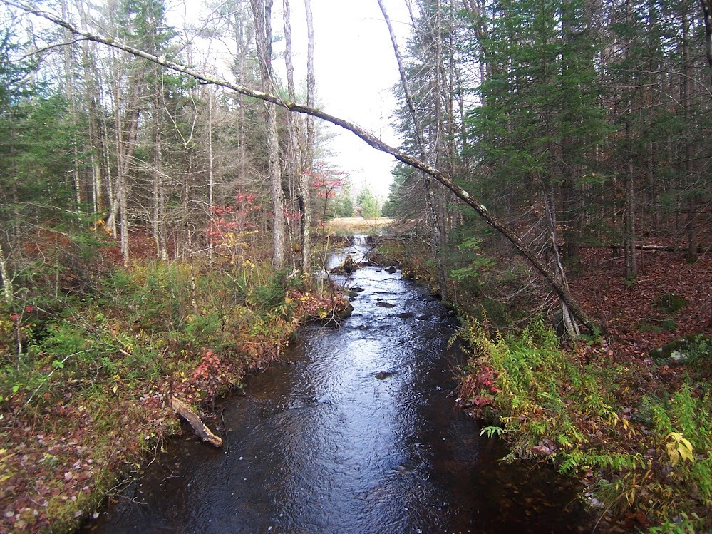
Shanty Cliffs Oct-21-2017
10-20-2017 Siamese Ponds Wilderness
Parked off Route 8 and crossed the East Branch of the Sacandaga River at the old cable crossing (no cable there now). I followed the path to Shanty Falls. Then, I went off trail and climbed the hill to the west (610m) and crossed a couple other small knobs before reaching Shanty Cliffs. Checked out the ledges on both sides of the dike before descending the climbers path back to Route 8. Then it was a short walk back to the car. Fall colors are past peak in this area with many leaves down, but still some pockets of color.
some pictures
vendredi 20 octobre 2017
cmp sites near ticonderoga
Looking for nice RV sites near ft. Ticonderoga or at least within 30-40 minutes. any ideas, or hidden gems. also if any advice on things to do or see I would appreciate it. will be going in late july.
thanks
CP
thanks
CP
jeudi 19 octobre 2017
Pond Tactic: Multiple Flies
Hypothetically speaking of course......
I arrive to fish an ADK Brookie pond, see no surface activity, and have no idea where the fish are. I'd like to explore the entire water column using 3 or 4 flies, spaced at roughly equal intervals, on the leader.
Consider the following drawing:

Am I thinking about this right?
Most of my Stillwater knowledge is based on Denny Rickards' books and videos. One of his "no-no's" is fishing subsurface flies with a floating line. Yet I'd think - with the appropriate length leader it would be perfect for probing the entire water column.
In the UK, they do just this, fishing 2 or 3 flies under a "bung" (strike indicator) or they'll remove the bung, replacing it with a 3rd or 4th fly. Both were originally used with chironomids and the latter is referred to as "straight line buzzer fishing". Either can be used with other nymphs/wets.
Thought I'd ask all of you what I'm missing.......
I arrive to fish an ADK Brookie pond, see no surface activity, and have no idea where the fish are. I'd like to explore the entire water column using 3 or 4 flies, spaced at roughly equal intervals, on the leader.
Consider the following drawing:
Am I thinking about this right?
Most of my Stillwater knowledge is based on Denny Rickards' books and videos. One of his "no-no's" is fishing subsurface flies with a floating line. Yet I'd think - with the appropriate length leader it would be perfect for probing the entire water column.
In the UK, they do just this, fishing 2 or 3 flies under a "bung" (strike indicator) or they'll remove the bung, replacing it with a 3rd or 4th fly. Both were originally used with chironomids and the latter is referred to as "straight line buzzer fishing". Either can be used with other nymphs/wets.
Thought I'd ask all of you what I'm missing.......
Wolf Run, Bowman Creek, Bean Run Loop
https://endlessmountains.wordpress.c...n-loop-sgl-57/
http://ift.tt/2kYMsII
This was a 5ish mile loop hike we did in the summer in SGL 57 (PA).* Features moderate terrain, lots of superb streamside hiking, isolation, big rocks, pools, cascades, and a wilderness view from Coyote Rocks.* The forests were beautiful with hardwoods, spruce, and fern meadows.* A great "bang for your buck" type hike.
End of the season brookies
We didn't get out as much as we usually do but we had some variety in terms of size and color this last season and put a few good ones in the net. http://ift.tt/2imLxRu
mardi 17 octobre 2017
a little off topic but important
i have to book for next year already for our two week adk vacation. was hoping to find a nice spot to camp (camper full hook up preferred but not necessary) near fort Ticonderoga lake George area. thought we would go up that way and see some different stuff then head over to fish creek for remainder of two weeks. anyone recommend anything or anyplace or secret gems. normally we come up 28/30 through old forge, blue mtn, long lake, etc.
I tried looking stuff up on my own but nothing is really sticking out to me.
Thanks in advance
Cp
I tried looking stuff up on my own but nothing is really sticking out to me.
Thanks in advance
Cp
Lows upper dam/floating bog conditions
I plan to go into Lows Lake later this week and I would like any current info on the construction at the upper dam and the floating bog just upstream. Is the water level around the bog low? I'm hauling a wall tent/stove etc and just trying to figure if it will be an added portage or float-able.
Thank You
Thank You
Using the forum 'search' feature
Can anyone tell me how to use the forum search so that it looks to find more than a single word by itself? In other words, the search would be performed looking for a pair of words or more grouped together, or possibly even a phrase.
For example, if I were to search for "Hour Pond" the results would be posts with either the word 'hour' or 'pond' occurring in them by themselves, rather than both words together and in order. Getting every occurrence of the word 'pond' obviously does little to narrow the search as it appears thousands of times. Same with the word 'hour'.
That was just one specific example, but the problem frequently frustrates me when searching various topics. Consider "High Falls", "Lows Ridge", "Lake George", "Little Moose Mountain" - the list could go on and on.
I've tried searching with the two or more words in quotation marks, but that makes no difference.
Is there some simple method with which a search can be done in this manner?
Lake Lila, Oct 1-Oct 3
My buddy Greg and I used a couple of vacation days to check out Lake Lila. He's lives down in the Catskills and doesn't get to the Adirondacks as much as he would like to, and this was his first trip to Lake Lila. Our goal was to canoe in Sunday, find a place to camp, then on Monday we'd head over to the west end and climb Frederica mountain, and visit the Nahasane station, a private train station that served William Seward Webb's Lodge. It was of particular interest to Greg, since his brother is an engineer for the Adirondack Scenic Railroad, and currently this section of track is only used for moving equipment, since it's pretty deteriorated.
We pulled into the parking lot at around 11 am, figuring the late start would give some of the weekend campers time to pack up and get out, and we weren't disappointed. There were probably 5 or 6 cars in the lot, and one truck with a canoe carrier trailer. I was a little apprehensive about the carrier, since that usually means a large group of renters, and I wasn't wrong on that count. We were traveling fairly light in comparison to the people we saw unloading -- we only had two packs, a canoe, and a bag of kiln-dried hardwood that we felt ridiculous buying, but we figured it would come in handy if we ended up on an island campsite that had been stripped of downed wood.
We opted to take two trips to the water, because my canoe weighs about 57 lbs, and we're old and lazy. We brought the canoe down first, and the shoreline was a bit of a madhouse. Canoes and kayaks all over, coolers, people milling about on the beach getting their PFDs on, etc. We stuck our canoe off to the side and headed back to the parking lot. On the way back, we heard a squeaking noise coming up the trail and a few seconds later we see a guy with a cement covered wheelbarrow, hauling a cooler, a case of beer and some other junk. As he passed he laughed and said, "We're doing a little construction down there." I replied, "I feel bad for the poor bastard who got stuck hauling the bricks," and we stepped off the trail to let him pass.
We grabbed our packs, hiked back down to the water, and were on our way before the large group even got their boats wet, thinking we'd put as much distance between us and them as possible - and as soon as possible. The water was like glass. The sky was a brilliant blue. It was cool enough so there were no bugs. You couldn't ask for a better day to be out there.

Approximately 30 seconds after we paddled away, the large group got their mojo working and everyone was in the water. As we paddled past the first island, I looked behind me and they were all heading in the same direction we were. They were pretty loud, and we wanted to be as far away from them as we could be, so we stopped paddling until they caught up. "Where are you planning to camp?" I asked. "We don't know yet," they said. "Why?" I laughed and said, "Well, to be honest, we just wanted to be as far away from you guys as possible." He grinned and said, "You saw the beer, eh?" I laughed and said, "Yeah, that was my tip off." They were from all over the place, and the guy I was talking to was an Aussie. They were planning to do some rock climbing.
They said they heard there was a lean-to on the lake, so I pointed them in the general direction of where they'd need to go, and we peeled off to the right. After a bit more paddling, we decided site number 4 looked pretty good. It was half way down the lake, with possibilities of a good sunset view. It was a neat site and one I hadn't been on before. The site was a center spot carved from blow down that was mostly rotted, and fresh little trees were growing between them, (and sometimes out of them) which gave you kind of a "fenced in" feel. But the ground was level, there was room for two single-man tents, and the fire pit was in good shape. The site was clean and had a thunderbox that was disconcertingly close to where the tents were pitched, and with little privacy, but at least it wasn't full.

Site 4 view east:

There was a bit of a minefield getting the canoe into the site because of barely submerged boulders that were tough to see, and I left a fair amount of gel coat behind.
After exploring a bit and gathering up some firewood for later, we hung our hammocks and had dinner (mountain house, nothing fancy) and then used about half our store-bought wood to get the punkier stuff we had gathered burning well. We headed to bed around ten, hoping to get an early start the next day.
The next morning, we woke to what sounded like rain, but was only dew falling from the trees.
I pulled myself out of my tent and got the stove fired up to boil some water for coffee and oatmeal. Since we had the canoe, I had packed a few extra extravagances, one of which was my home coffee kit -- a hand grinder, an Aeropress and fresh coffee beans. After breakfast, we got out the maps and made our plan. The fog was starting to lift, but the lake was still mostly socked in, and we couldn't see more than maybe 100 yards from shore. It was beautiful though.

We figured we'd paddle to the west shore, drop the boat at a place on the map that was laughingly referred to as "boat launch" and then hike up Frederica to see what there was to see. It was a short 1.5 mile hike up the back side, and we figured by the time we got down it would be time for lunch and we could hike the tracks over to the Nehasane station and have lunch there.
The view from Frederica was nice, but it's not a very high mountain, so you are still relatively close to the lake:

We hung out at the top for a bit, and we noticed quite a few iron or steel eyelets in the rock at regular intervals, like perhaps at one point in time there had been a tower or structure of some kind there. Anyone know?
After that, we hiked back down and followed the tracks to Nehasane station.

It's gone down hill significantly in the last decade, and I doubt if what's left will make it through one more winter. The back wall was bowed out badly, and the side porch was also barely holding its own:


We sat on the porch and had lunch, and the heat plus our location, plus food brought the stable flies out in full force. Luckily, we both had long pants on, and didn't get bitten much.
As we were just about to start hiking back toward the canoe, we heard what sounded like a dirt bike, far away but coming our way quick. I walked back up to the tracks, and tried to see if I could spot it, but there was nothing. When it didn't seem to get much louder, Greg said, "Is that a drone?" And it was. My first experience with a drone in the wilderness, and I didn't care for it much. I told him I didn't think it was legal to be flying it in that area, but there wasn't much we could do. From what we could tell, I am pretty sure they were flying it around the cliffs at the base of Frederica. My guess is that it was one of the rock climbers.
After that, we paddled back to our site, fishing a little on the way but got skunked. Closer to dusk, we tried again from shore, but Greg was the only one that got a hit. We dined well that night, my friends:

Just kidding. There wasn't enough for both of us.
A bit later, around dinner time, we heard the familiar buzzing whine, and part of the original group we came in with stopped in the middle of the lake for another drone go-round. They brought it back in after a few minutes, and then continued heading out with all their stuff. I never did find out where they stashed the wheelbarrow.
After that, we enjoyed another quiet night with a nice fire and some good conversation, and the next morning we packed up early and headed out. We made a single trip on the way out, carrying our packs and the canoe. I can confirm that we made the right decision on the way in by making two trips. It seemed like our packs were twice as heavy with the wet tents and gear.
It was a great trip, and I was glad to see that no birch trees were peeled, no garbage was left in the fire pit, and the site was clean of any metal grates or other junk. The way it should be!
A couple more pics to finish up:


We pulled into the parking lot at around 11 am, figuring the late start would give some of the weekend campers time to pack up and get out, and we weren't disappointed. There were probably 5 or 6 cars in the lot, and one truck with a canoe carrier trailer. I was a little apprehensive about the carrier, since that usually means a large group of renters, and I wasn't wrong on that count. We were traveling fairly light in comparison to the people we saw unloading -- we only had two packs, a canoe, and a bag of kiln-dried hardwood that we felt ridiculous buying, but we figured it would come in handy if we ended up on an island campsite that had been stripped of downed wood.
We opted to take two trips to the water, because my canoe weighs about 57 lbs, and we're old and lazy. We brought the canoe down first, and the shoreline was a bit of a madhouse. Canoes and kayaks all over, coolers, people milling about on the beach getting their PFDs on, etc. We stuck our canoe off to the side and headed back to the parking lot. On the way back, we heard a squeaking noise coming up the trail and a few seconds later we see a guy with a cement covered wheelbarrow, hauling a cooler, a case of beer and some other junk. As he passed he laughed and said, "We're doing a little construction down there." I replied, "I feel bad for the poor bastard who got stuck hauling the bricks," and we stepped off the trail to let him pass.
We grabbed our packs, hiked back down to the water, and were on our way before the large group even got their boats wet, thinking we'd put as much distance between us and them as possible - and as soon as possible. The water was like glass. The sky was a brilliant blue. It was cool enough so there were no bugs. You couldn't ask for a better day to be out there.
Approximately 30 seconds after we paddled away, the large group got their mojo working and everyone was in the water. As we paddled past the first island, I looked behind me and they were all heading in the same direction we were. They were pretty loud, and we wanted to be as far away from them as we could be, so we stopped paddling until they caught up. "Where are you planning to camp?" I asked. "We don't know yet," they said. "Why?" I laughed and said, "Well, to be honest, we just wanted to be as far away from you guys as possible." He grinned and said, "You saw the beer, eh?" I laughed and said, "Yeah, that was my tip off." They were from all over the place, and the guy I was talking to was an Aussie. They were planning to do some rock climbing.
They said they heard there was a lean-to on the lake, so I pointed them in the general direction of where they'd need to go, and we peeled off to the right. After a bit more paddling, we decided site number 4 looked pretty good. It was half way down the lake, with possibilities of a good sunset view. It was a neat site and one I hadn't been on before. The site was a center spot carved from blow down that was mostly rotted, and fresh little trees were growing between them, (and sometimes out of them) which gave you kind of a "fenced in" feel. But the ground was level, there was room for two single-man tents, and the fire pit was in good shape. The site was clean and had a thunderbox that was disconcertingly close to where the tents were pitched, and with little privacy, but at least it wasn't full.
Site 4 view east:
There was a bit of a minefield getting the canoe into the site because of barely submerged boulders that were tough to see, and I left a fair amount of gel coat behind.
After exploring a bit and gathering up some firewood for later, we hung our hammocks and had dinner (mountain house, nothing fancy) and then used about half our store-bought wood to get the punkier stuff we had gathered burning well. We headed to bed around ten, hoping to get an early start the next day.
The next morning, we woke to what sounded like rain, but was only dew falling from the trees.
I pulled myself out of my tent and got the stove fired up to boil some water for coffee and oatmeal. Since we had the canoe, I had packed a few extra extravagances, one of which was my home coffee kit -- a hand grinder, an Aeropress and fresh coffee beans. After breakfast, we got out the maps and made our plan. The fog was starting to lift, but the lake was still mostly socked in, and we couldn't see more than maybe 100 yards from shore. It was beautiful though.
We figured we'd paddle to the west shore, drop the boat at a place on the map that was laughingly referred to as "boat launch" and then hike up Frederica to see what there was to see. It was a short 1.5 mile hike up the back side, and we figured by the time we got down it would be time for lunch and we could hike the tracks over to the Nehasane station and have lunch there.
The view from Frederica was nice, but it's not a very high mountain, so you are still relatively close to the lake:
We hung out at the top for a bit, and we noticed quite a few iron or steel eyelets in the rock at regular intervals, like perhaps at one point in time there had been a tower or structure of some kind there. Anyone know?
After that, we hiked back down and followed the tracks to Nehasane station.
It's gone down hill significantly in the last decade, and I doubt if what's left will make it through one more winter. The back wall was bowed out badly, and the side porch was also barely holding its own:
We sat on the porch and had lunch, and the heat plus our location, plus food brought the stable flies out in full force. Luckily, we both had long pants on, and didn't get bitten much.
As we were just about to start hiking back toward the canoe, we heard what sounded like a dirt bike, far away but coming our way quick. I walked back up to the tracks, and tried to see if I could spot it, but there was nothing. When it didn't seem to get much louder, Greg said, "Is that a drone?" And it was. My first experience with a drone in the wilderness, and I didn't care for it much. I told him I didn't think it was legal to be flying it in that area, but there wasn't much we could do. From what we could tell, I am pretty sure they were flying it around the cliffs at the base of Frederica. My guess is that it was one of the rock climbers.
After that, we paddled back to our site, fishing a little on the way but got skunked. Closer to dusk, we tried again from shore, but Greg was the only one that got a hit. We dined well that night, my friends:
Just kidding. There wasn't enough for both of us.
A bit later, around dinner time, we heard the familiar buzzing whine, and part of the original group we came in with stopped in the middle of the lake for another drone go-round. They brought it back in after a few minutes, and then continued heading out with all their stuff. I never did find out where they stashed the wheelbarrow.
After that, we enjoyed another quiet night with a nice fire and some good conversation, and the next morning we packed up early and headed out. We made a single trip on the way out, carrying our packs and the canoe. I can confirm that we made the right decision on the way in by making two trips. It seemed like our packs were twice as heavy with the wet tents and gear.
It was a great trip, and I was glad to see that no birch trees were peeled, no garbage was left in the fire pit, and the site was clean of any metal grates or other junk. The way it should be!
A couple more pics to finish up:
"Topo Map Browser" Site Down
For on line maps, I have generally used:
http://ift.tt/2zfVmE3
Anyone else notice that this site has been down for the last couple days?
Colden46, I think you used to manage that site; are you still here?
http://ift.tt/2zfVmE3
Anyone else notice that this site has been down for the last couple days?
Colden46, I think you used to manage that site; are you still here?
Bennies Brook herd path
Climbed Bennies on Saturday. WOW. :)
Came across a cairn and a herd path below the headwall. From pictures I'd seen of the headwall it seemed that this exit from the slide was too early. But there was a cairn and a path so we took the exit.
While there was a clear path we were walking on vegetation. Further up we were joined by a bare earth path coming in from the slide that was clearly the "main" herd path.
In retrospect I think I should have descended, removed the cairn, and brushed in the "incorrect" herd path. I think most people would prefer to climb the slide as long as possible and not form an unnecessary herd path.
Unless people disagree perhaps someone should remove the "incorrect" cairn next time through. I assume the "correct" path is also marked with a cairn.
Dwiki Dharmawan: Tanah AMI Awards 2017 Lebih terurai

© Bintang Online Dwiki Dharmawan, Ketua Umum Yayasan Anugeran Musik Indonesia. (Ari/tabloidbintang.com)
Ajang penghargaan Anugerah Musik Indonesia
Hi teman terbaik ke situs dewasa sexybokep.com menonton film selamat hari
(AMI) 2017 akan digelar di Garuda Teater, Taman Mini Indonesia Indah, Jakarta Timur, 16 November 2017 mendatang.Musisi Dwiki Dharmawan selaku Ketua Umum Yayasan Anugeran Musik Indonesia (YAMI), mengungkapkan pihaknya terus melakukan penyempurnaan dalam metode penilaian.
Masyarakat tidak hanya jadi penonton, tapi juga bisa terlibat langsung untuk menentukan pemenang dari masing-masing kategori.
"Kami berharap dengan perbaikan kerangka kerja secara menyeluruh, maka semua proses dapat djalankan secara fair, transparan, dan berintegritas sehingga hasilnya dapat dipertanggungjawabkan kepada publik," ungkapnya, dalam jumpa pers di Jakarta.
Sementara itu, Noorcahyo Irianto Istyabudi, salah satu panitia AMI Awards, mengungkapkan adanya peningkatan signifikan terhadap jumlah karya yang masuk pada AMI Awards 2017 dibandingkan tahun sebelumnya
"Tahun lalu ada 771 entry, tahun ini 1.073 lagu. Sehingga, ada growth sekitar 71 persen dari tahun lalu. Sebanyak 667 lagu dikirim secara online, dan 406 lagu masih dikirim offline," urainya.
Semua karya yang terdaftar dimasukkan ke dalam 52 kategori yang dikompetisikan. Ada beberapa kategori baru yang muncul di AMI Awards 2017, salah satunya musik religi.
lundi 16 octobre 2017
Last Three Days
Pond 1 on Friday - UpstateDave and I fished a new pond that he found. Of course that meant it was his day to out-fish me (not that it takes much). We caught beautiful, solid brookies to 16" with a couple of grabs from what may have been more substantial fish. The magic fly was Dave's skinny, purple leech, fished on a clear intermediate line. Highlight of the day was seeing a mother bear and cub on the shore.
Pond 2 on Saturday - This is a gem that kicked out monster fish for us this Spring. It just plain didn't fish, turning out 2 14" fish for a day's effort. Highlight of the day: while tromping through a dry bog, I heard cracking branches on the other side. Here comes a young bull moose high stepping it through the bog straight toward me. I dropped my pack and ran to the side and got behind the first substantial tree. He came straight for me, head low and nostrils flared. He stopped maybe 20 feet away, snorting and breathing hard. It was probably 4 or 5 minutes before he decided I wasn't a threat and walked off. It's okay now that I have clean underwear and a beer in front of me. My adrenaline level has declined perceptibly over the last two days.
Pond 3 on Sunday - This is a pond we have fished for years, some better than others. I quickly found a pod of fish, all females, all 15" to 18". After catching several I left to explore the rest of the pond. Nada, so I came back, a long kick into the wind. Not only were the females there, the boys had joined them. Highlight of the day: 6 fish, all 17" to 18" in ten casts. And all they wanted was a simple dragonfly nymph, fished about 5 feet down.
And so ends the 2017 season. It feels like we should have 2 more weeks. Water temps are still in the high 50's!!!
Inscription à :
Commentaires (Atom)